Most urbanized states in America
Bustling, productive cities are critical to the nation’s economy and well-being. They make money, provide skilled workers with quality jobs and good wages, offer a buffet of creative and business opportunities, foster culture and the arts, and more. Cities are booming, especially in the American South and West. The trend to urbanization is strong in America, and nearly everyone today lives in what is considered an urban or metropolitan area.
Most American cities grew organically, either situated on a navigable waterway, evolving into a center for trade, or rising from the prairie when the railroads arrived. Today they might be the headquarters of powerful corporate conglomerates or the energized and supportive backdrop for innovative tech startups.
However, the move toward urbanization easily gets out of hand. Development tramples open green space, poorly planned roads create traffic nightmares, policies favorable to single-family structures leave too many people unable to afford a decent roof over their heads, and air and water are polluted. In one telling statistic, research found that for every 1% of population growth, land use consumption has jumped as much as 8%. The unpleasant term “urban sprawl” connotes messy, oversized intrusion into rural areas, thoughtlessly wasted space, and unsightly development along the fringes of cities. Metropolitan areas stretch unchecked and meet in a patchwork of no design.
Nevertheless, many urban leaders in America have begun to understand these problems and are being creative and prescient in trying to control urban growth and limit sprawl, seeking a balance between the promotion of necessary and efficient development and the protection of the forests, beaches, and grassy plains.
To determine the most urbanized states in America, Stacker used data from the U.S. Department of Agriculture’s Economic Research Service (ERS). All 50 states are ranked on the basis of the percent of their total land that is covered by urban areas as of 2012, the most recent survey year which is available from ERS (data released in 2017).
Keep reading to find out where your state ranks for urban development.
You may also like: The 100 best cities to raise a family
#50. Alaska
- State covered by urban areas: <0.1% (166,427 acres)
--- Change from 2002: -0.3% (167,000 acres)
- State's biggest land use: Special-use areas (40.0% of state, 146.2 million acres)
The most rural state, Alaska has just two areas considered urban by the U.S. Census Bureau—Anchorage and Fairbanks. Anchorage got its start in 1915 with construction of a railroad to reach into the state’s interior, grew as a strategically critical site during World War II, and today serves as headquarters for oil companies.
#49. Wyoming
- State covered by urban areas: 0.2% (127,802 acres)
--- Change from 2002: 17.2% (109,000 acres)
- State's biggest land use: Grassland pasture and range (74.2% of state, 46.1 million acres)
Wyoming’s two largest cities owe their existence to the railroads. The location of Cheyenne, now the capital, was selected in 1867 as a depot by the Union Pacific Railroad that was building its route westward from Omaha, Nebraska, and Council Bluffs, Iowa. Further to the northwest, the city of Casper began when the Fremont, Elkhorn & Missouri Valley Railroad built its tracks in 1888 for shipping cattle and wool.
#48. Montana
- State covered by urban areas: 0.2% (194,916 acres)
--- Change from 2002: 16.0% (168,000 acres)
- State's biggest land use: Grassland pasture and range (51.1% of state, 47.6 million acres)
Though Montana is hardly considered urban, about 80% of its residents live within 50 miles of its seven growing cities. Five of the cities—Missoula, Kalispell, Bozeman, Helena, and Butte—are located in the Western Mountain region that has accounted for most of the state’s recent population growth. The other two cities are Great Falls to the north and Billings to the east.
#47. North Dakota
- State covered by urban areas: 0.3% (122,517 acres)
--- Change from 2002: 30.3% (94,000 acres)
- State's biggest land use: Cropland (61.4% of state, 27.1 million acres)
Fargo and West Fargo, at North Dakota’s eastern border with Minnesota, have been growing in population more than the combined growth of its five cities to the west (Bismarck, Mandan, Dickinson, Williston, and Watford City), where the state’s oil activity is primarily located. Fargo and West Fargo have more diverse economies, and Cass County, where they are located, has had the biggest influx of new foreign-born residents.
#46. South Dakota
- State covered by urban areas: 0.3% (152,283 acres)
--- Change from 2002: 41.0% (108,000 acres)
- State's biggest land use: Grassland pasture and range (51.5% of state, 25.0 million acres)
The fastest-growing city of South Dakota, Sioux Falls, was first settled by land speculators on the banks of the Big Sioux River in the mid-1800s. The original settlement was abandoned by white settlers, who left due to a Native American uprising in 1862 but returned when Fort Dakota was built nearby for protection. The arrival of the railroad in 1878 sparked the city’s first boost in population, and today its economy is a mix of agribusiness, finance, and health care services.
#45. Idaho
- State covered by urban areas: 0.6% (331,204 acres)
--- Change from 2002: 25.9% (263,000 acres)
- State's biggest land use: Grassland pasture and range (34.8% of state, 18.4 million acres)
Idaho’s growth has been concentrated in its 200 incorporated cities, where population has grow faster than the rest of the state. The fastest-growing are Idaho’s 15 mid-sized cities. Only Boise and Meridian have more than 100,000 residents, and Meridian was the fifth-fastest-growing city in the nation from 2010 to 2019.
#44. New Mexico
- State covered by urban areas: 0.7% (538,703 acres)
--- Change from 2002: 11.3% (484,000 acres)
- State's biggest land use: Grassland pasture and range (70.0% of state, 54.3 million acres)
Among New Mexico’s 33 counties, six are considered entirely rural, and another six mostly rural. But two-thirds qualify as urban, according to 2010 Census data. Two urban areas that attract population in particular are the counties that are home to Los Alamos National Labs and Cannon Air Force Base. Santa Fe’s population grew more than 20% from 2012 to 2017, in part from an influx of residents and in part from an annexation of 4,100 acres of land that added more than 13,000 residents.
#43. Nebraska
- State covered by urban areas: 0.7% (344,212 acres)
--- Change from 2002: 17.5% (293,000 acres)
- State's biggest land use: Grassland pasture and range (48.2% of state, 23.7 million acres)
Nebraska’s rural north lost population, and its rural south has held steady, but the southeastern urban areas of Lincoln and Omaha are booming. In 2018, 56.5% of the state’s population lived in urban areas. The economy of the largest city, Omaha, is diversified, from packaged-food giant ConAgra to the Berkshire Hathaway conglomerate, Union Pacific railroad, and Mutual of Omaha insurance.
#42. Nevada
- State covered by urban areas: 0.7% (519,795 acres)
--- Change from 2002: 48.5% (350,000 acres)
- State's biggest land use: Grassland pasture and range (74.5% of state, 52.3 million acres)
The city of Las Vegas, the focal point of the state’s tourism and hospitality industry, is one of the nation’s fastest-growing metropolitan areas. Its population soared from 273,000 in 1972 to 2.2 million in 2017. In 1950, fewer than 25,000 people lived in the desert city. In 2019, nearly 21,000 people moved to Nevada from neighboring California.
#41. Utah
- State covered by urban areas: 1.2% (614,139 acres)
--- Change from 2002: 38.3% (444,000 acres)
- State's biggest land use: Grassland pasture and range (62.3% of state, 32.8 million acres)
Approximately nine out of 10 residents live in an urban setting in Utah, one of the fastest-growing states in the nation. Much of the working population live in cities and towns along the front range of the Wasatch Mountains, drawn there in large part by jobs in the state’s dynamic high-tech industry.
#40. Maine
- State covered by urban areas: 1.2% (230,553 acres)
--- Change from 2002: 3.4% (223,000 acres)
- State's biggest land use: Forest (87.1% of state, 17.2 million acres)
Maine’s urban population has declined over the past several decades. According to the U.S. Census Bureau, about half of Maine’s residents lived in urban areas—including Portland, Biddeford, Bangor, and Lewiston—in 1950. By the 2010 Census, that number had dropped, and fewer than 40% of residents were urban, the lowest proportion of all the U.S. states.
#39. Oregon
- State covered by urban areas: 1.2% (718,656 acres)
--- Change from 2002: 8.6% (662,000 acres)
- State's biggest land use: Forest (39.3% of state, 24.1 million acres)
Every city and metropolitan area in Oregon has an urban growth boundary at its edges that is used to control land use and prevent urban sprawl in adjacent farmland and forests. Under the law, greater Portland, the state’s largest city, must have enough land within its urban growth boundary for 20 years of growth, to be used for housing and commercial construction. The boundary is reassessed every six years and has been expanded roughly 36 times.
#38. Kansas
- State covered by urban areas: 1.2% (636,695 acres)
--- Change from 2002: 14.9% (554,000 acres)
- State's biggest land use: Cropland (54.6% of state, 28.6 million acres)
Despite Kansas’ image of wide-open spaces, more than half its population lives in a town or larger city. The biggest city, Wichita, was an Indigenous trading center before white settlers arrived. It became a destination for cattle drives from Texas and later a center for the grain, oil, and aviation industries. Smaller cities like Lawrence and Manhattan are college towns that consistently attract residents, and Salina got its start as a grain storage and rail locale.
#37. Colorado
- State covered by urban areas: 1.5% (1.0 million acres)
--- Change from 2002: 24.3% (814,000 acres)
- State's biggest land use: Grassland pasture and range (47.8% of state, 31.7 million acres)
Growth in Denver, Colorado’s largest city, is outpacing the rest of the state. In the last decade, its population has grown by more than 20%. The fastest-growing counties lie along Colorado’s Front Range urban corridor, while among its least populated counties, a number have shrunk since 2010. Bent and Kit Carson Counties in the state’s Eastern Plains have lost more than 14% of their populations.
#36. Vermont
- State covered by urban areas: 1.7% (101,040 acres)
--- Change from 2002: 6.4% (95,000 acres)
- State's biggest land use: Forest (75.9% of state, 4.5 million acres)
Vermont has been losing population, even in its cities, since the 2010 Census. From 2010 to 2019, it overall population fell 0.3%, compared with the nation’s population rise of 6.1%. More Vermont towns and cities lost residents than gained them, and even among growing towns, nearly all of them grew more slowly than the national average. Nearly all of Vermont’s cities—Montpelier, St. Albans City, Middlebury, Rutland City, Brattleboro, and Bennington—lost population.
#35. Iowa
- State covered by urban areas: 1.8% (627,751 acres)
--- Change from 2002: 20.5% (521,000 acres)
- State's biggest land use: Cropland (74.7% of state, 26.7 million acres)
Looking at ways to control urban growth in Iowa, state lawmakers considered a measure that would prohibit cities from annexing farmland that is deemed at least 45% suitable for raising corn. It would have stopped farmland from being annexed by a city if it were being put on the market for development. According to local research, almost 4% of the state’s prime farmland was removed from production from 1977 to 2012.
#34. Oklahoma
- State covered by urban areas: 1.9% (855,996 acres)
--- Change from 2002: 16.3% (736,000 acres)
- State's biggest land use: Grassland pasture and range (45.0% of state, 19.8 million acres)
Among the nation’s biggest urban areas, Oklahoma City stretches 621 square miles, and authorities have sought ways to stop its sprawl. Its size has proven unwieldy, as the need for street repairs and water lines to keep pace with a rising population has become financially burdensome. A mix of urban neighborhoods, suburbs, shopping areas, business districts, and rural stretches, Oklahoma City reaches into four counties. In 1890, when it was incorporated, the city was five blocks wide and 15 blocks long.
#33. Arizona
- State covered by urban areas: 2.0% (1.5 million acres)
--- Change from 2002: 35.6% (1.1 million acres)
- State's biggest land use: Grassland pasture and range (59.9% of state, 43.6 million acres)
In the decades from 1950 to 2010, the rate of population growth in the nation’s desert Southwest from Texas to California was at least twice as high as the nation’s overall rate. In the region, nearly nine out of 10 residents lived in Arizona, and Maricopa, which includes Phoenix, is the biggest county with almost 4.5 million people. Construction job growth in the county is expected to grow, along with job opportunities in the health care, education, and hospitality industries.
#32. Arkansas
- State covered by urban areas: 2.2% (726,539 acres)
--- Change from 2002: 24.8% (582,000 acres)
- State's biggest land use: Forest (55.7% of state, 18.5 million acres)
Most of Arkansas’ cities have been growing, while its rural areas have been declining, a trend that has benefited whiter, wealthier areas over poorer, majority-Black regions. The places growing most have been home to major research universities such as the University of Arkansas in Fayetteville and Arkansas State University in Jonesboro, as well as military bases. One city not growing, however, is Pine Bluff, which lost slightly more than 10% of its population from 2010 to 2018. Its violent crime rate is more than two-and-a-half times higher than the rest of the country, and its jobless rate is high as well.
#31. Minnesota
- State covered by urban areas: 2.2% (1.1 million acres)
--- Change from 2002: 15.6% (966,000 acres)
- State's biggest land use: Cropland (44.1% of state, 22.5 million acres)
The population of the Twin Cities soared from 2010 to 2018. Minneapolis became home to 12.2% new residents, and St. Paul drew nearly 10% more newcomers. Available housing, however, increased just 6.4%, so prices and rents rose. Overall, the state’s population growth is expected to slow, with only the metropolitan areas, which besides the Twin Cities includes Rochester and Fargo-Moorhead, growing faster than the state average.
#30. Mississippi
- State covered by urban areas: 2.4% (730,139 acres)
--- Change from 2002: 21.9% (599,000 acres)
- State's biggest land use: Forest (64.9% of state, 19.5 million acres)
Among large U.S. cities, Jackson, Mississippi, had the second-highest rate of population decline from 2010 to 2019, losing about 7% (13,000 residents), according to the U.S. Census. Its job growth has also been negative, while cities like Madison and Hattiesburg have fared better, with higher income and more employment options. Cities that rely heavily on casino gaming for revenue faced major shortfalls due to COVID-related shutdowns, such as Biloxi (which gets a third of its tax monies from gaming), Gulfport, D’Iberville, Greenville, Natchez, and Vicksburg.
#29. West Virginia
- State covered by urban areas: 2.7% (419,651 acres)
--- Change from 2002: 15.3% (364,000 acres)
- State's biggest land use: Forest (76.6% of state, 11.8 million acres)
All of the job growth in recent years has been in West Virginia’s metropolitan and urban areas, where the population grew 5% between 2000 and 2010. Rural residents have been left with few employment options outside of resource extraction and industry, along with less education, lower incomes, and poorer health. Advocates for balancing the state’s uneven growth rates have called for investment in policies to expand high-speed internet, improving rural health care, and managing the opioid crisis.
#28. Missouri
- State covered by urban areas: 3.1% (1.3 million acres)
--- Change from 2002: 14.9% (1.2 million acres)
- State's biggest land use: Cropland (35.5% of state, 15.6 million acres)
Founded at the junction of the Missouri and Kansas rivers, Kansas City underwent a giant expansion post-World War II, using annexation to stretch its boundaries and add huge swaths of land that were turned into strip malls, suburbs, and subdivisions. From 1946 to 1964, its population grew 12% to about 486,000, and its land area grew 423% to 314 square miles. More recently, its inner-city population has dropped, and infrastructure like roads and sanitation in the sprawling annexed sections has become costly to maintain with revenue from the city’s smaller core tax base. St. Louis, meanwhile, has invested heavily in infrastructure and services to attract high-tech innovators and entrepreneurs.
#27. Texas
- State covered by urban areas: 3.5% (5.8 million acres)
--- Change from 2002: 26.6% (4.6 million acres)
- State's biggest land use: Grassland pasture and range (62.6% of state, 104.6 million acres)
Frisco, part of the Dallas-Fort Worth metropolitan area, is the fastest-growing city in the country. It has increased its population by more than half since 2010, with a growth rate of 71.1%. The North Texas region, originally supporting an economy based on cattle and railroads, is attracting young people with jobs in finance, software development, and cybersecurity. Cities in Texas are among the nation’s urban areas adding the most residents in the past decade. Together, Austin, San Antonio, Houston, Dallas, and Fort Worth have gained more than 900,000 residents.
#26. Wisconsin
- State covered by urban areas: 3.6% (1.2 million acres)
--- Change from 2002: 17.4% (1.1 million acres)
- State's biggest land use: Forest (48.3% of state, 16.7 million acres)
Wisconsin’s largest city, Milwaukee, has been losing residents, while Madison, at half the size, has been gaining. Milwaukee’s population fell by several thousand, while Madison’s population grew slightly more than 1%. Those moving out of Milwaukee tend to be young adults, research shows, while jobs in startups and the tech sector are drawing people to Madison.
#25. Washington
- State covered by urban areas: 3.7% (1.6 million acres)
--- Change from 2002: 13.6% (1.4 million acres)
- State's biggest land use: Forest (42.5% of state, 18.1 million acres)
Washington law since 1990 has required counties to designate 20-year Urban Growth Area (UGA) boundaries for each city that limit how far a municipality can expand, and land outside the boundaries cannot be annexed. The UGA boundaries are an effort at compact, higher-density urban growth to keep costs down, reduce water use, make public transportation more efficient, and protect rural areas and farmland from sprawl and unwelcome development.
#24. Kentucky
- State covered by urban areas: 3.7% (928,010 acres)
--- Change from 2002: 18.5% (783,000 acres)
- State's biggest land use: Forest (47.0% of state, 11.9 million acres)
The city of Lexington was the first in the nation to enact an Urban Growth Boundary. Implemented in 1958, the boundary was an effort to control development and protect surrounding horse farms. Rural areas were zoned at no less than 40 acres. As in many states, Kentucky’s rural regions have lost population, such as Martin County, a former coal-mining region near the West Virginia border that is struggling with a polluted water supply and lost 13.4% of its population between 2010 and 2019.
#23. Alabama
- State covered by urban areas: 4.5% (1.5 million acres)
--- Change from 2002: 28.8% (1.1 million acres)
- State's biggest land use: Forest (70.3% of state, 22.8 million acres)
Urbanization in Alabama has been uneven, with the city of Huntsville booming but many other cities flagging. Huntsville is home to a Mazda Toyota plant and a Facebook data center. Meanwhile, the state’s largest city, Birmingham, has been shrinking in population, as have the capital city of Montgomery and Mobile, Birmingham, and Anniston. Selma, the iconic civil rights site, saw its population numbers drop 17% from 2010 to 2020.
#22. Louisiana
- State covered by urban areas: 4.7% (1.3 million acres)
--- Change from 2002: 21.4% (1.1 million acres)
- State's biggest land use: Forest (53.0% of state, 14.6 million acres)
Early in 2020, the governor of Louisiana named a task force to address the needs of rural towns and parishes, where median household incomes in some regions are less than half the national numbers. Nearly one in five people live in rural poverty, schools are performing badly, and internet access is severely lacking. Critics say the state has focused too much on development along the Mississippi River, as well as on infrastructure and tax policies benefiting the oil and gas industries that boost the economies and populations of cities like Lafayette, Lake Charles, Baton Rouge, and New Orleans.
#21. California
- State covered by urban areas: 5.3% (5.3 million acres)
--- Change from 2002: 4.0% (5.1 million acres)
- State's biggest land use: Grassland pasture and range (26.7% of state, 26.7 million acres)
Almost 95% of California residents live in metropolitan areas, mostly in Southern California, and many in communities built up along freeways laid down in the 1950s and 1960s. Some experts say Los Angeles is the epitome of urban sprawl. Once a Spanish colonial outpost, the city grew with little oversight to become home to 4 million people, while the county has 10 million residents, and the greater Los Angeles metropolitan region has 18 million people living on about 4,850 square miles.
#20. Hawaii
- State covered by urban areas: 6.2% (256,433 acres)
--- Change from 2002: 13.0% (227,000 acres)
- State's biggest land use: Forest (31.6% of state, 1.3 million acres)
Unlike most cities, Honolulu, on the Hawaiian island of Oahu, has been shedding population over recent years. The urbanized island lost almost 62,000 people who moved to the mainland from 2013 to 2019. Those who leave typically cite Hawaii’s high cost of living, particularly housing prices, as well as a lack of employment opportunities.
#19. Michigan
- State covered by urban areas: 6.5% (2.4 million acres)
--- Change from 2002: 9.4% (2.2 million acres)
- State's biggest land use: Forest (53.2% of state, 19.3 million acres)
In Michigan, four of every five residents live in an urban county or a suburban county in a metropolitan area, while fewer than one in 10 live in a rural county. More young people live in the metropolitan areas than in rural areas, discouraging businesses who want a supply of future employees from moving out of established urban regions. About one in eight metropolitan-area workers in Michigan earns at least $100,000 a year, compared with just one in 17 rural workers.
#18. Virginia
- State covered by urban areas: 6.9% (1.7 million acres)
--- Change from 2002: 14.3% (1.5 million acres)
- State's biggest land use: Forest (60.9% of state, 15.4 million acres)
Historically, Virginia was slow to urbanize. While nationwide, more Americans lived in urban than rural areas as of 1920, in Virginia that sweeping move did not occur until 1950. Its cities started to grow after the Civil War, when freed formerly enslaved people arrived looking for work and the nation’s railroad system was expanding. Today, half of the state’s population lives in Northern Virginia or in the Hampton Roads region that includes Chesapeake, Newport News, Norfolk, and Virginia Beach, and of Virginia’s nearly 9 million residents, just about 1 million live in rural areas.
#17. Indiana
- State covered by urban areas: 7.2% (1.7 million acres)
--- Change from 2002: 16.5% (1.4 million acres)
- State's biggest land use: Cropland (55.4% of state, 12.7 million acres)
Indianapolis got its start when Indiana became a state in 1816, and it was decided that the capital city should be in its geographical center. The new city was reachable only by roadway until the railroad arrived in 1847. More recently, Indianapolis has made a concerted effort to revive and enliven its downtown over the last two decades and has made investments to lure entrepreneurial and innovative businesses. In particular, it has a number of high-tech startups focusing on virtual training, bioinformatics, and business performance metrics like SaaS optimization.
#16. Illinois
- State covered by urban areas: 7.2% (2.6 million acres)
--- Change from 2002: 11.8% (2.3 million acres)
- State's biggest land use: Cropland (67.4% of state, 23.9 million acres)
Midwestern cities have been shrinking, according to the U.S.Census Bureau, and among them are Illinois’ Rockford and Decatur. Such cities, once reliant on manufacturing and heavy industry no longer there, have not found ways to diversify their economies and attract new post-industrial businesses, so residents leave in search of better opportunities, according to labor and urban experts.
#15. Tennessee
- State covered by urban areas: 7.3% (1.9 million acres)
--- Change from 2002: 22.6% (1.6 million acres)
- State's biggest land use: Forest (51.2% of state, 13.5 million acres)
Urbanization in Tennessee is being fueled by growth in cities in the middle of the state like Murfreesboro and Clarksville, as well as the Nashville metropolitan area. Middle Tennessee offers employment opportunities in health care and in business startups. Memphis is falling behind. Advocates for the Mississippi River city say it needs to find ways to improve its infrastructure such as public transportation; improve its housing stock; and address its severe poverty issues to attract high-tech businesses.
#14. New Hampshire
- State covered by urban areas: 7.4% (423,250 acres)
--- Change from 2002: 18.6% (357,000 acres)
- State's biggest land use: Forest (75.8% of state, 4.3 million acres)
Among the fastest-growing areas in New Hampshire are its southern and southeastern regions that are part of the sprawling Boston metropolitan area and include its two biggest cities, Manchester and Nashua. Growth has stagnated or dropped in the northern rural regions that rely on extraction industries like forest products and mining, notably Coös County along the Canadian border, once a mainstay of wood and paper production.
#13. South Carolina
- State covered by urban areas: 8.3% (1.6 million acres)
--- Change from 2002: 32.5% (1.2 million acres)
- State's biggest land use: Forest (67.7% of state, 13.0 million acres)
Cross-border urban growth into South Carolina from Charlotte, North Carolina, is raising issues of how neighboring regions will keep pace with infrastructure and transportation. It’s not uncommon for workers with jobs in Charlotte to live across the border in South Carolina, where housing costs and taxes can be lower. The Charlotte population grew almost 20% from 2010 to 2020.
#12. Georgia
- State covered by urban areas: 8.7% (3.2 million acres)
--- Change from 2002: 33.2% (2.4 million acres)
- State's biggest land use: Forest (66.2% of state, 24.4 million acres)
Atlanta is arguably a textbook case of urban sprawl. The city was the fourth fastest-growing metro area in 2020, and three counties growing the most in the state are within or next to the Atlanta metropolitan region. It has more than 16,000 miles of roads, and thus significant issues with traffic congestion and air quality. The quality of the Chattahoochee River, the water source for half the state’s population, is threatened by development, inadequate sewer systems, pavement runoff, and seeping waste from septic tanks.
#11. New York
- State covered by urban areas: 8.7% (2.6 million acres)
--- Change from 2002: 4.1% (2.5 million acres)
- State's biggest land use: Forest (52.8% of state, 15.9 million acres)
An oft-discussed topic during the pandemic has been the flight of people leaving New York City, but experts say the city has been losing residents for the past decade. Before the coronavirus, it ranked as the nation’s second-highest city in terms of falling population, due in part to a slowing of new residents coming from overseas. Looking ahead, however, the population of New York City is likely to be affected dramatically as workers opt to continue working from home, giving them more freedom of mobility. Some experts predict a 20% drop in demand for New York City office space.
#10. North Carolina
- State covered by urban areas: 9.9% (3.1 million acres)
--- Change from 2002: 34.5% (2.3 million acres)
- State's biggest land use: Forest (58.1% of state, 18.1 million acres)
Growth and dynamics in North Carolina illustrate the state’s urban and rural divide. Almost three times as many counties have lost residents, compared to those whose population increased by 10% or more. Employment in the private sector grew in urban areas and dropped in rural counties. In rural areas, experts say agriculture jobs have given way to mechanization, manufacturing was undercut by foreign competition, shrinking tax revenues led to cuts in education, and people left for better opportunities.
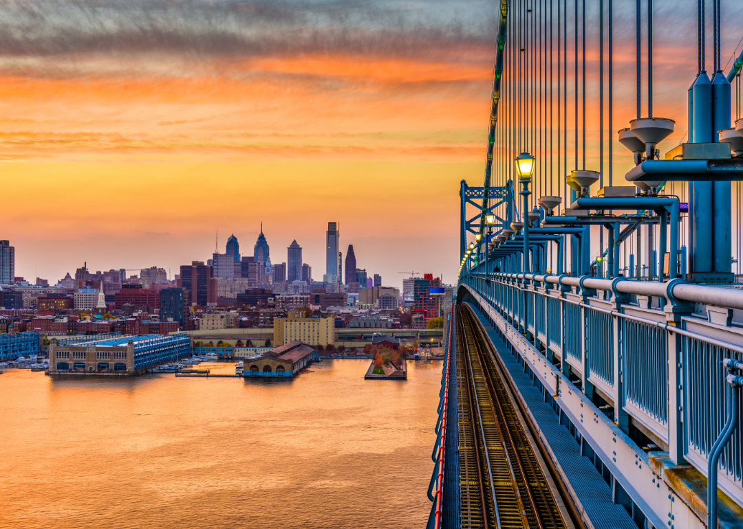
#9. Pennsylvania
- State covered by urban areas: 10.7% (3.1 million acres)
--- Change from 2002: 11.8% (2.7 million acres)
- State's biggest land use: Forest (56.7% of state, 16.2 million acres)
Research by the U.S. Census Bureau shows dramatic differences between urban and rural Pennsylvania. About a quarter of the state’s residents lived in a rural county as of 2018. Almost three times as many foreign-born residents lived in urban areas, compared to rural, and household income for urban dwellers was about 25% higher than those in rural areas.
#8. Ohio
- State covered by urban areas: 11.0% (2.9 million acres)
--- Change from 2002: 12.2% (2.6 million acres)
- State's biggest land use: Cropland (41.4% of state, 10.8 million acres)
Bucking the shrinking trend among Midwestern cities, Columbus, Ohio has been keeping up, with growth in its population, incomes, and housing prices. Its population has more than doubled since 1960, and its per capita income growth was higher than that of Cincinnati, Cleveland, and the rest of the country. To accomplish this, Columbus has become home to thriving startups, investing in attracting tech and taking advantage of resources at Ohio State University.
#7. Florida
- State covered by urban areas: 14.3% (4.9 million acres)
--- Change from 2002: 23.8% (4.0 million acres)
- State's biggest land use: Forest (46.1% of state, 15.8 million acres)
Jacksonville is growing fastest among Florida cities, followed by Miami and Tampa. The bulk of newcomers have arrived from elsewhere in Florida, while Fort Lauderdale tends to attract young professionals, often from larger cities, to its professional and business services sectors. Tampa is also attracting highly skilled workers from other cities like Orlando and New York.
#6. Maryland
- State covered by urban areas: 21.1% (1.3 million acres)
--- Change from 2002: 12.4% (1.2 million acres)
- State's biggest land use: Forest (37.5% of state, 2.3 million acres)
Maryland was a pioneer in land use policy aimed at controlling urban growth. It set up the nation’s first statewide planning commission in 1933 and passed forward-thinking legislative measures known as Smart Growth in 1997. Smart Growth used state spending on infrastructure as incentives, instead of regulations, to guide development into Priority Funding Areas (PFAs) and slow sprawling growth outside them.
#5. Delaware
- State covered by urban areas: 22.0% (273,820 acres)
--- Change from 2002: 40.4% (195,000 acres)
- State's biggest land use: Cropland (35.1% of state, 437,863 acres)
Cities in Delaware reveal dramatic differences in urban locales just miles apart. Middletown, a half-hour’s drive to the south of Wilmington, has a median household income more than double its neighbor to the north, but about one-fifth the poverty rate. Industries fueling the economy have been finance, insurance, legal services, and health care.
#4. Connecticut
- State covered by urban areas: 38.0% (1.2 million acres)
--- Change from 2002: 4.0% (1.1 million acres)
- State's biggest land use: Forest (43.4% of state, 1.3 million acres)
At the start of 2020, Connecticut Gov. Ned Lamont set out a goal of doubling the population of the state’s cities over the next 25 years. In the state’s effort to avoid becoming a sea of suburban office parks and bedroom communities, officials are hoping to address such issues as affordable housing, public transportation, and incentives for businesses that offer high-paying jobs. Bridgeport, the largest city, has been focused on adding downtown apartments, while Hartford has reformed zoning to encourage redevelopment.
#3. Massachusetts
- State covered by urban areas: 38.8% (1.9 million acres)
--- Change from 2002: 7.1% (1.8 million acres)
- State's biggest land use: Forest (41.8% of state, 2.1 million acres)
In Massachusetts, advocates are campaigning to boost so-called “gateway cities,” the mid-sized urban centers that are key to regional economies. Such cities have declined as manufacturing jobs disappeared and have struggled to reposition themselves economically. Those cities include Brockton, once the largest producer of shoes in the country; Worcester, the home of 10 colleges and universities; and Holyoke, one of the country’s first planned industrial cities, which was designed so its canals would power its paper mills.
#2. Rhode Island
- State covered by urban areas: 39.0% (257,945 acres)
--- Change from 2002: 3.2% (250,000 acres)
- State's biggest land use: Forest (43.8% of state, 290,000 acres)
In 2006, Rhode Island adopted a set of measures and policies to control development and sprawl called Land Use 2025. It laid out goals, strategies, and priorities, envisioning Providence at the helm (with other cities as subcenters linked by transportation and services); a forested region in the western section of the state; and a protected oceanfront. It advocated an “urban-rural” approach promoting intensive land use with mass transit and affordable housing on the one hand, and preserving natural resources and open spaces on the other.
#1. New Jersey
- State covered by urban areas: 40.1% (1.9 million acres)
--- Change from 2002: 5.1% (1.8 million acres)
- State's biggest land use: Urban areas (40.1% of state, 1.9 million acres)
The most urbanized state in the country sits between the giant urban forces of New York and Philadelphia. Sixteen of New Jersey’s 21 counties, about 89% of its population, lie within the metropolitan areas of New York to the northeast or Philadelphia to the southwest. The locales with the most robust growth in New Jersey have been densely populated counties close to New York City that offer compact, walkable downtown areas and are magnets for those wishing to immigrate.