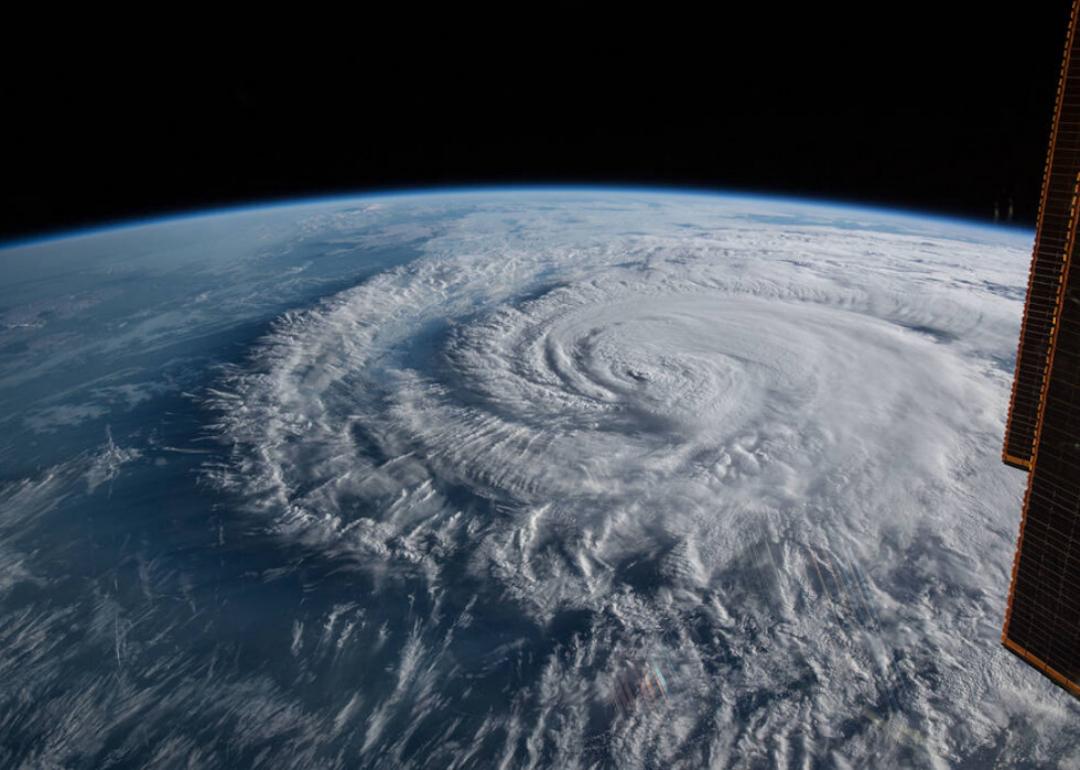
50 spectacular images of Earth from space
50 spectacular images of Earth from space
Our fascination with space and the worlds beyond our own comes from a deep-seated human desire to better understand our place in the universe. From satellite launches and manned missions to stepping on the moon and planning a visit to mars, our obsession with space exploration seems to only grow. As modern science expands and evolves, so too does its investigation of the cosmos—including thousands of satellites that are now orbiting the Earth.
Russia launched the first satellite, Sputnik, in 1957. The U.S. quickly followed with its own launch of Explorer 1 in 1958. Since then, NASA has had more than 200 successful, manned spacecraft launches and sent out more than 1,000 unmanned satellites.
While expeditions to strange new worlds sound exciting, one of the most important aspects of space exploration is that it allows scientists to study our own planet. Images of the Earth captured by satellites not only help scientists map things like population density, but they also showcase the effects of climate change, natural disasters, and major weather fronts. Utilizing the data from satellite images also provides a wide range of information about the Earth, from measuring plant growth to chemical deviations in the atmosphere.
The first satellite images were captured back in 1947 when scientist John T. Mengel conducted experiments by launching rockets into orbit and placing cameras on them. Today's satellite images are significantly more complex, and while they might look like simple photographs, they are actually the result of combining measurements of various light wavelengths.
Stacker curated a gallery of some of the most intriguing and interesting images of Earth from space. Sourced from NASA's various exploration programs via NASA's image library, these satellite images, captured from millions of miles away, show an up-close and personal view of our ever-changing planet.
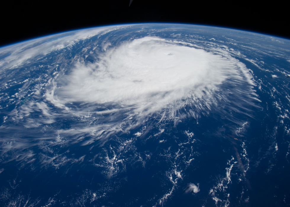
Hurricane Edouard
This image of Hurricane Edouard was taken in 2014, during NASA's 41st expedition to the International Space Station. Starting as a tropical storm in September 2014, Edouard intensified into a major hurricane that created dangerous ocean currents and swells along the East Coast. Edouard never touched down on land, but the cyclonic image as shown from space showcases the immense power of storms of this level.
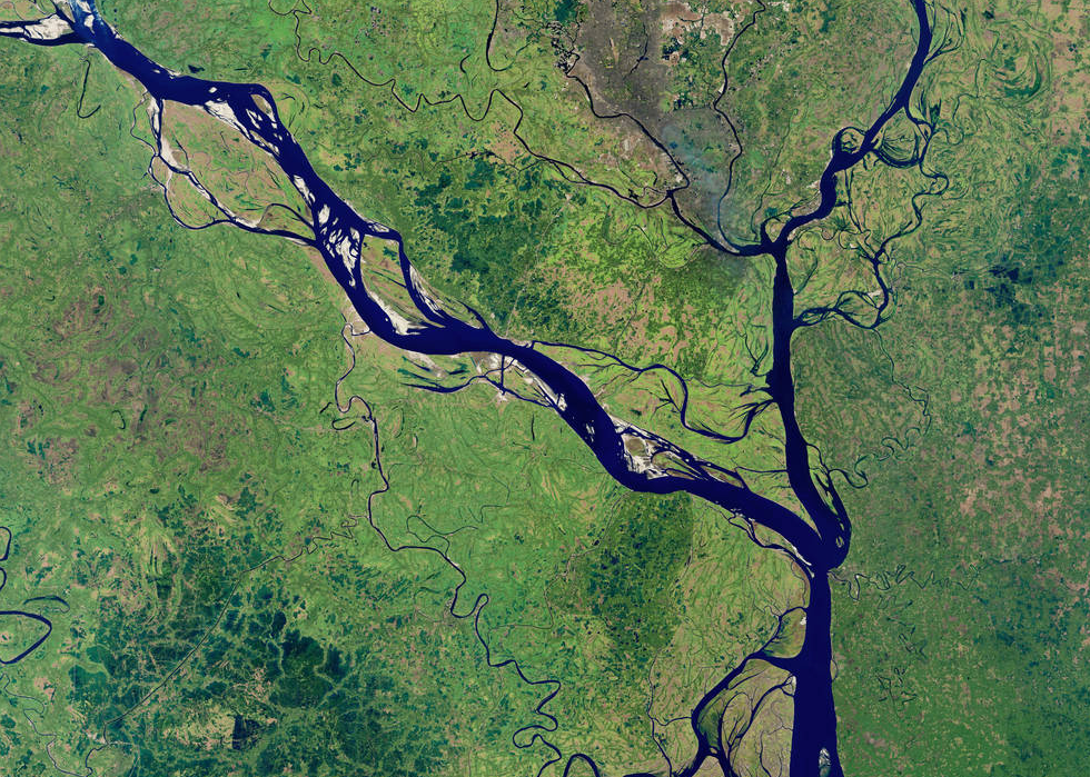
Padma River
Taken in January 2018 by NASA's Operational Land Imager (OLI), this image depicts one of Bangladesh's major rivers, the Padma River. Constant erosion causes the river to change and grow at alarming rates, and scientists have tracked this erosion for years in an attempt to determine a pattern.
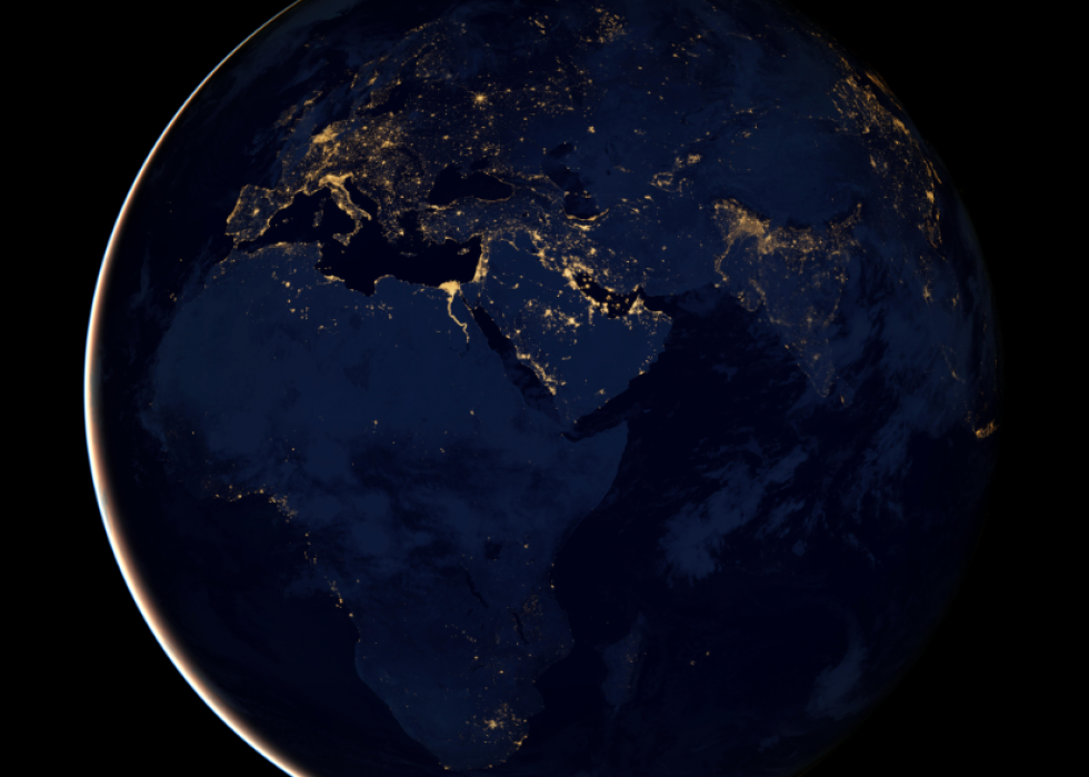
City lights of Africa, Europe, and the Middle East
A phenomenal view of Africa, Europe, and the Middle East, this composite image was collected via data from the Suomi NPP satellite and mapped over existing imagery of the Earth. The satellite has infrared imaging that allows it to detect light and filter out lights from other sources, focusing only on city lights, which can help in mapping major population areas.
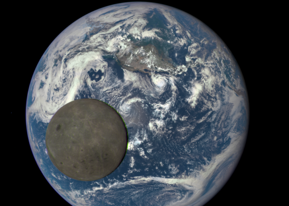
The dark side of the moon
This 2015 animation still shows the moon crossing the Earth. The camera aboard the Deep Space Climate Observatory (DSCOVR) satellite caught the dark side of the moon, a part that is never visible from Earth, in this perfect moment. While the photo looks close enough to touch, the satellite that took this photo is actually orbiting 1 million miles away.
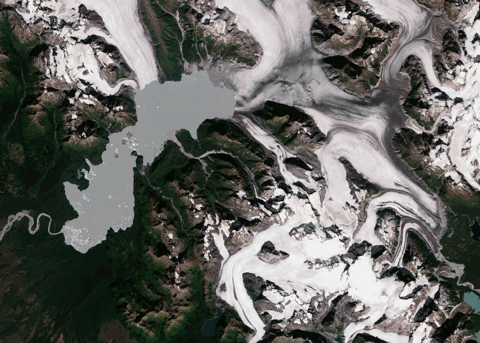
Yakutat Glacier
Captured by NASA's Operational Land Imager, this image of Yakutat Glacier in Alaska highlights the stunning beauty of glacier ice as seen from space. Unfortunately, pictures of the glacier also show just how much climate change has caused it to shrink. Scientists predict the Yakutat Glacier could be gone altogether by 2070 if climate warming continues at its current pace.
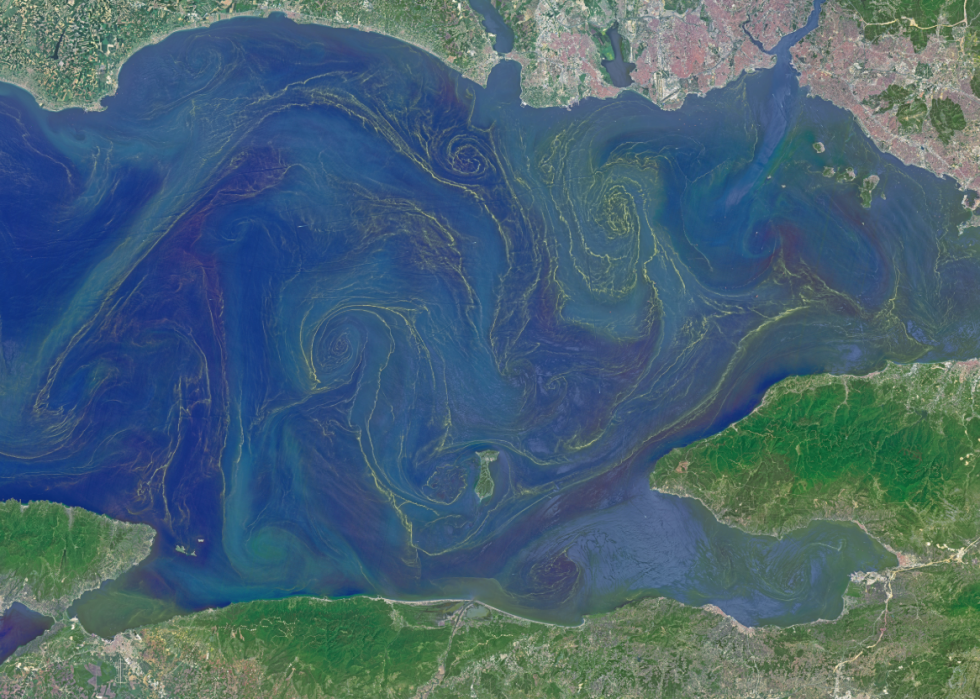
Plankton bloom in the Sea of Marmara
The Sea of Marmara, which sits between the Black and Aegean Seas, is unusual in that it consists of freshwater at the surface with saltier water at deeper levels. The freshwater encourages the growth of phytoplankton, a floating plant-like organism, which creates an interesting, swirled design from a distance. This image of that plankton bloom was taken by the Operational Land Imager on NASA's Landsat 8 satellite in 2015.
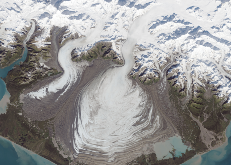
Malaspina Glacier
This image of Alaska's Malaspina Glacier, the largest piedmont glacier in North America, was taken by the Operational Land Imager on NASA's Landsat 8 satellite in 2014. The image clearly shows the moraines on the ice, which are seen as brown lines across the surface. Moraines are formed when glaciers surge or move quickly forward over a period of years, a phenomenon that is common for glaciers in this part of Alaska.
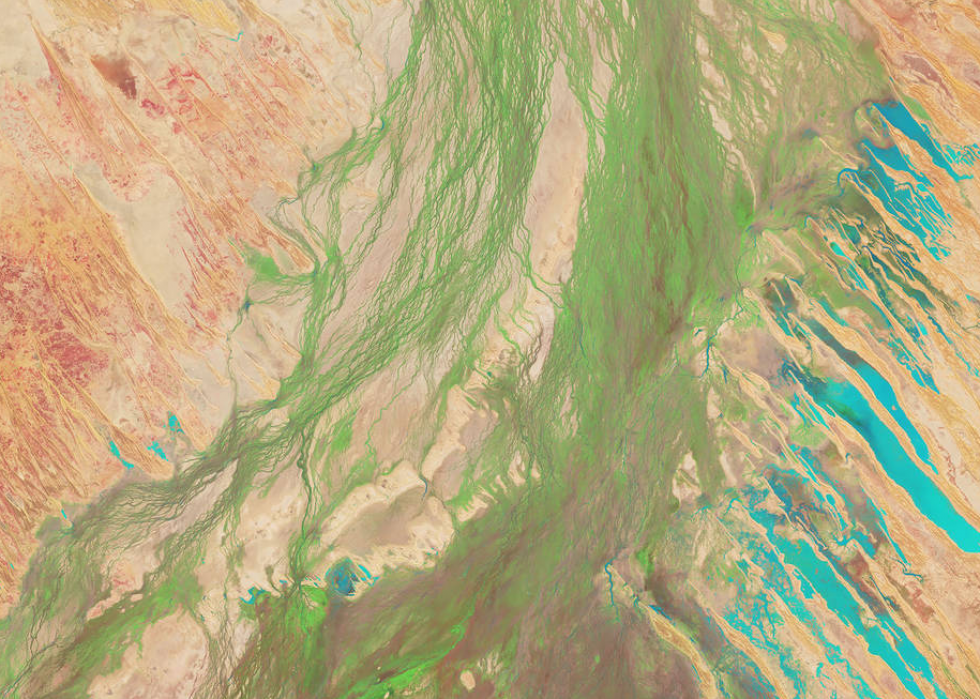
Lake Eyre Basin
Covering one-sixth of the country, Australia's Lake Eyre Basin is one of the largest internally draining river systems in the world. While the basin itself is often dry, heavy rains can mean sudden vegetation growth. Captured by Landsat 8's Operational Land Imager in April 2018, the light green on the image represents the vegetation and shows it taking over the areas where water has receded.
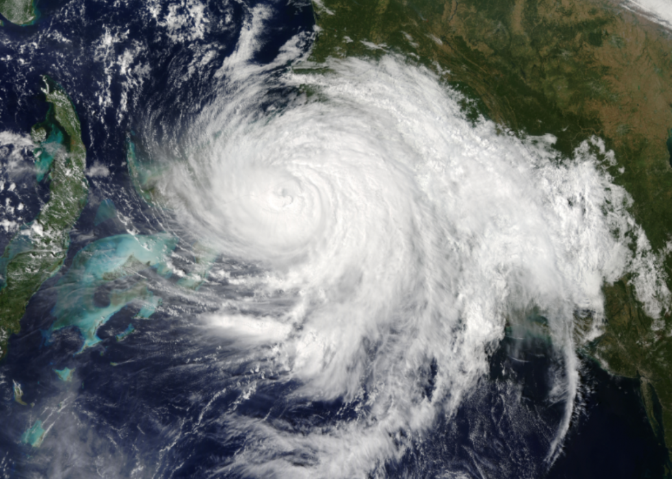
Hurricane Matthew
Hurricane Matthew developed from a tropical storm just off the coast of Africa, building into a Category 5 hurricane and wreaking havoc in the Caribbean, Bahamas, Cuba, Haiti, and portions of the United States. This 2016 image from NASA's Terra satellite shows Hurricane Matthew at Category 3, but the storm's power and intensity are still quite visible.
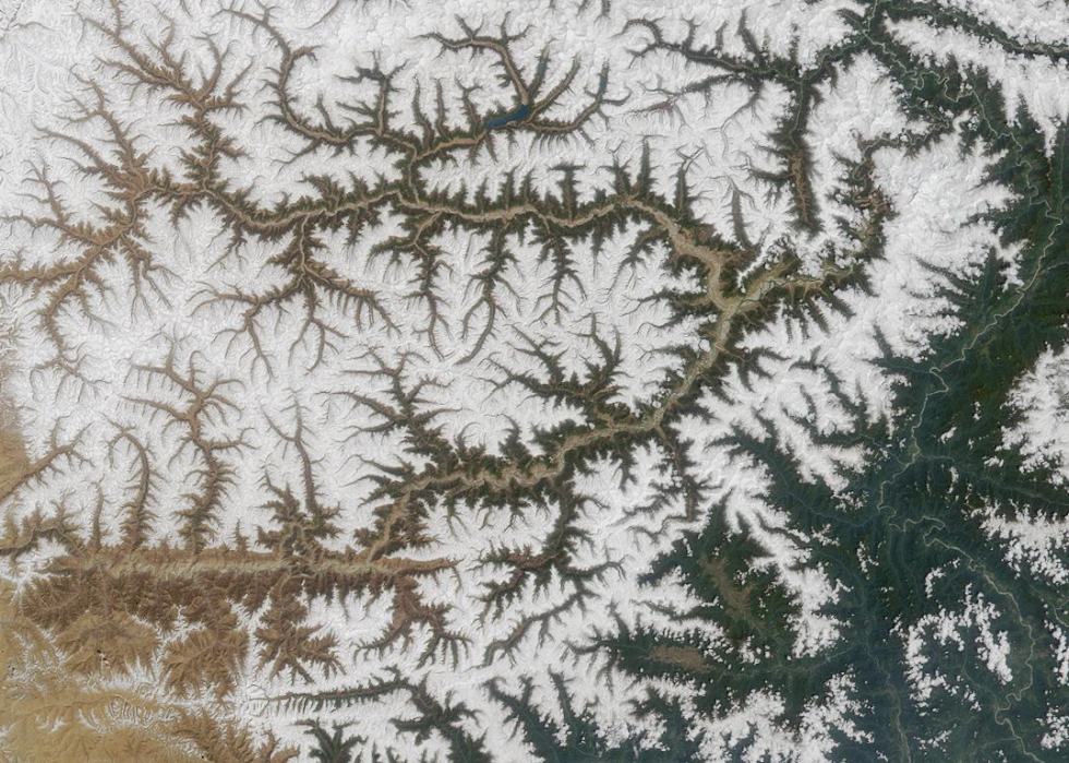
Yarlung Tsangpo River
Captured from NASA's Terra satellite in 2002, the Yarlung Tsangpo River is often referred to as the "Everest of Rivers" because of its frequent extreme conditions. The Yarlung Tsangpo River also has the highest elevation of any major river in the world.
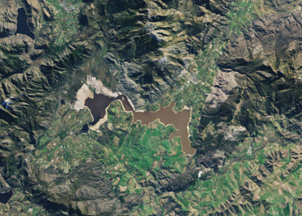
Theewaterskloof Dam
NASA's Operational Land Imager on the Landsat 8 satellite grabbed this shot of South Africa's Theewaterskloof Dam, Cape Town's largest reservoir, in July 2018. Due to ongoing drought conditions, the dam's water levels dropped to a mere 13% at one point, prompting heavy water restrictions for Cape Town residents, with the anticipation that the city could run out of water by April 2018. Luckily, intense conservation efforts coupled with unusually heavy rains have helped put the reservoir back to normal levels.
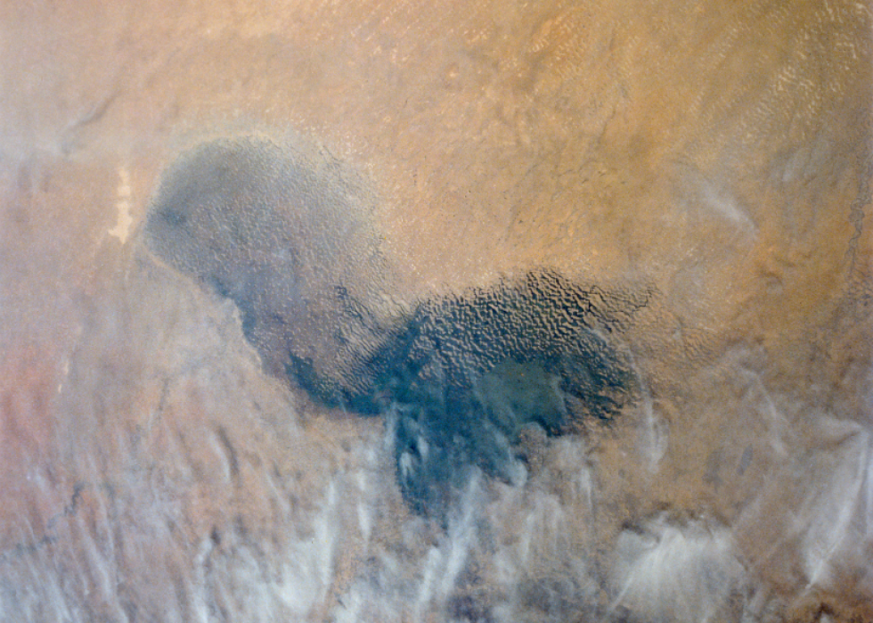
Lake Chad
Africa's Lake Chad was once as big as Michigan's Lake Erie, but today it is barely a 10th of its 1960s size. This image from NASA's Terra satellite documents the shrinking lake bed, which has diminished significantly over the last 30 years. The loss of this important resource has affected both the economy and lifestyle of the populations living near the lake. The increasingly dry climate coupled with the overuse of lake water for large irrigation projects has led to the lake's continued demise.
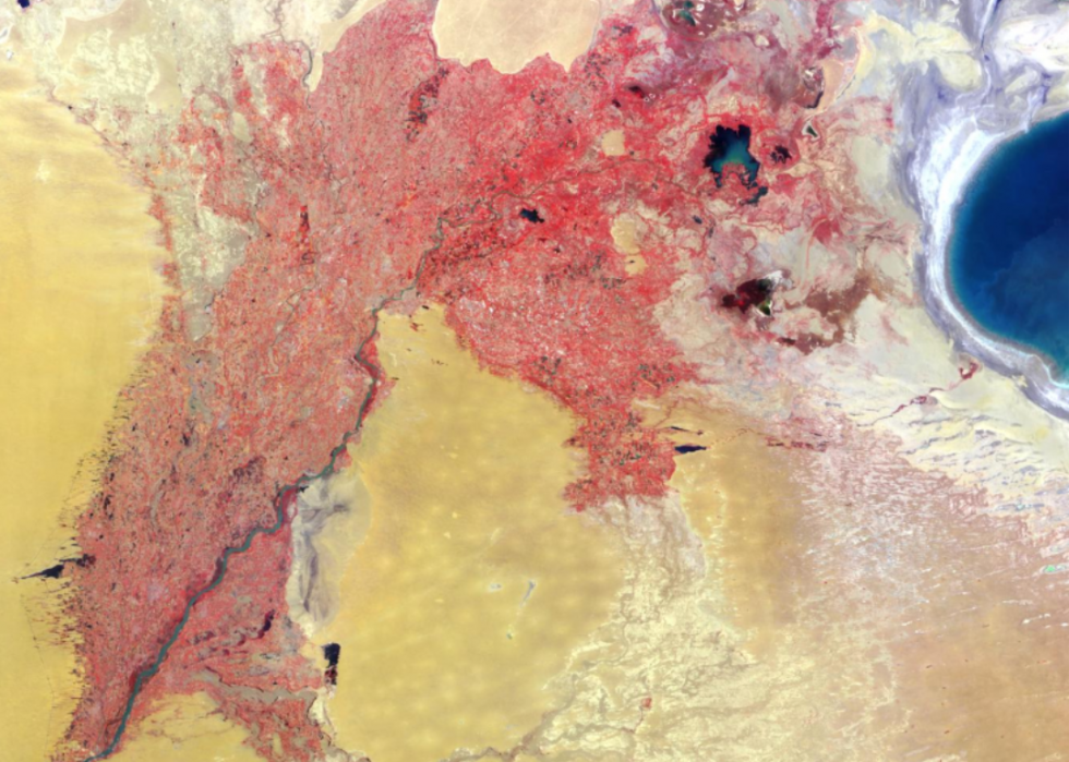
Uzbekistan and Turkmenistan
This image of western Uzbekistan and northeastern Turkmenistan was acquired via the Multi-angle Imaging SpectroRadiometer (MISR) instrument on NASA's Terra satellite. The area is bordered by the Caspian Sea, Iran, and Afghanistan, and the image depicts lakes and rivers in the region, as well as the nearby sea.
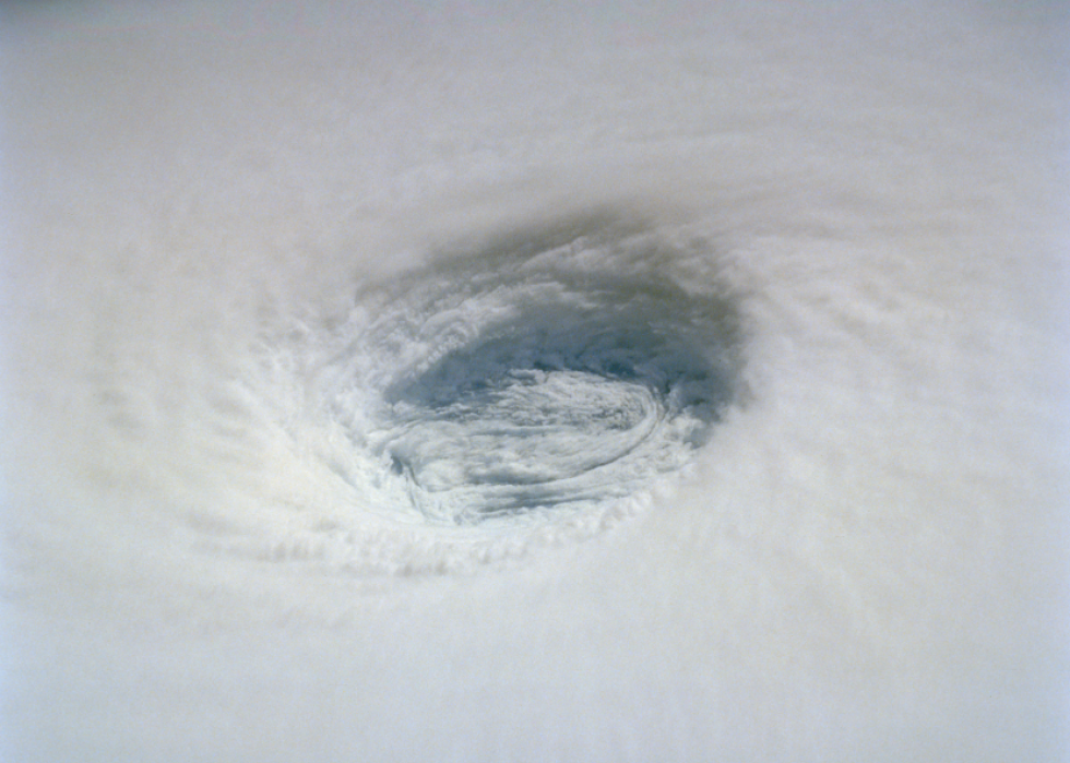
Super Typhoon Yuri
Super Typhoon Yuri hit in 1991, going from tropical storm to typhoon in a short amount of time and building to winds that reached more than 200mph. This NASA image shows the eye of the storm with the eyewall. The eye cylinder of this typhoon goes almost to the ocean's surface, a distance of nearly 50,000 feet.
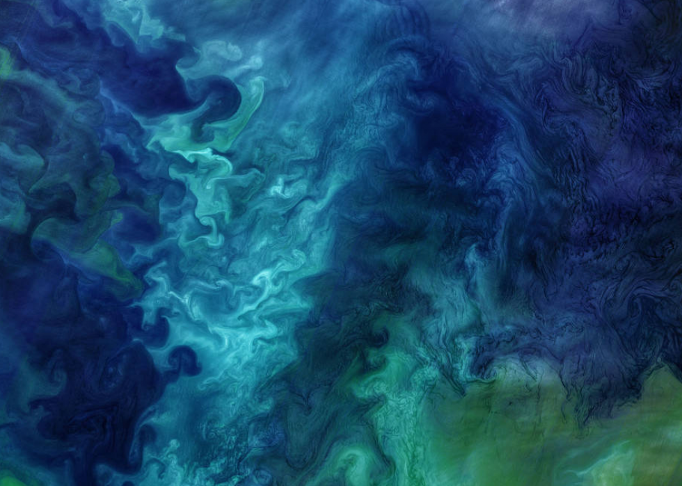
Chukchi Sea
This artful image of the Chukchi Sea in Alaska was captured by Operational Land Imager on Landsat 8 in the spring of 2018. The warmer weather breaks up the sea ice, which mixes with Alaskan coastal waters. The combination of different phytoplankton and surface waters helps algae grow, creating a look that is more painting than ocean water.
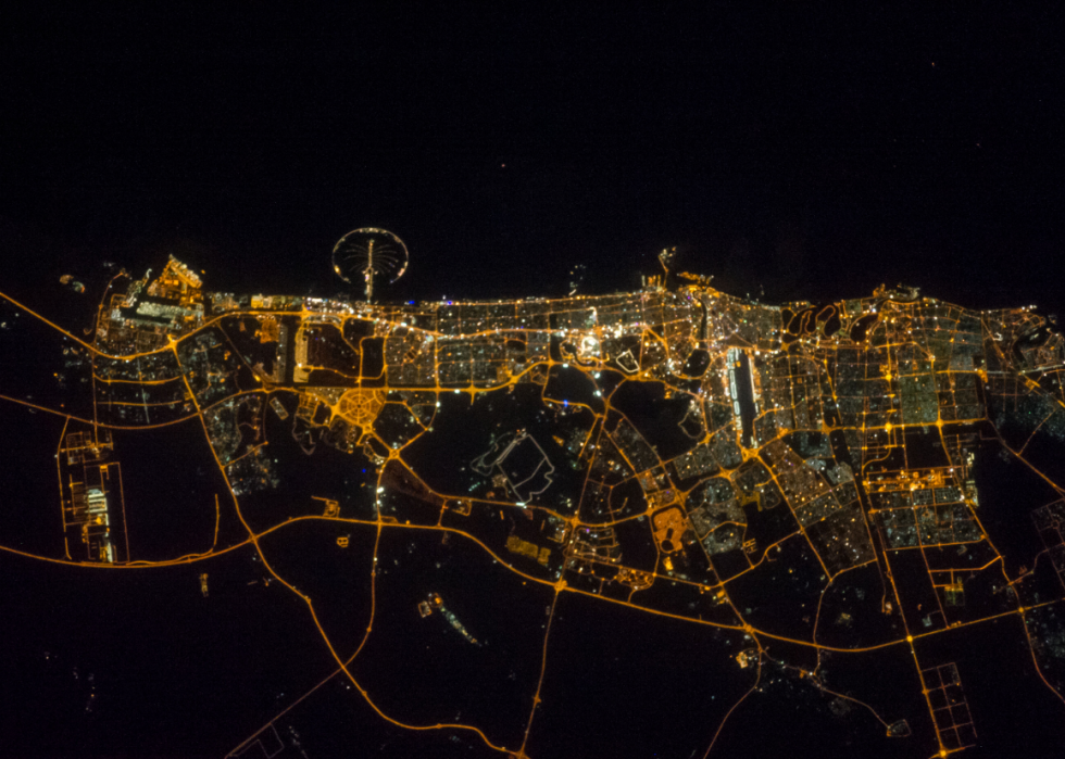
The Middle East at night
This nighttime view of the Middle East was taken by the Expedition 40 crew on NASA's International Space Station in 2014. Images captured at night help scientists map urban areas, highlighting major population zones and showing the opposing rural regions.
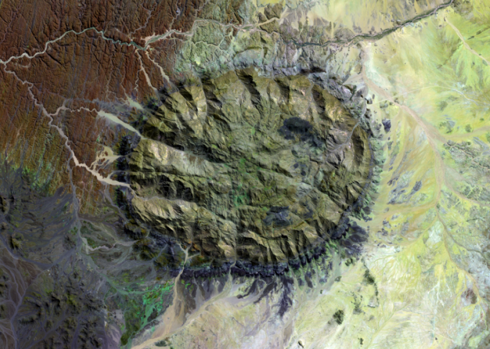
Brandberg Mountain
NASA's image of Brandberg Mountain, taken in 1993, shows just how much this peak stands out against the rest of the desert landscape. Located in the Namib Desert, it is the highest mountain in Namibia at 8,550 feet and even from the ground, it's visible from great distances across the desert. Created millions of years ago by volcanic activity, the Brandberg is often called the burning mountain, as it appears to glow red in the setting sun.
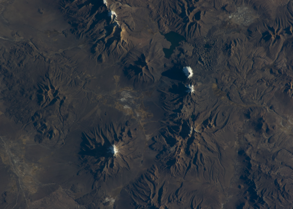
Chilean volcanoes
The Expedition 40 crew captured this shot of a range of Chilean volcanoes during a day pass across the Earth in 2014. While these volcanoes appear dormant, NASA's satellite imagery has often captured active volcanoes and eruptions around the world. In 2011, their Terra satellite caught images of Chile's Puyehue-Cordon Volcano as it erupted, along with its 6-mile ash plume.
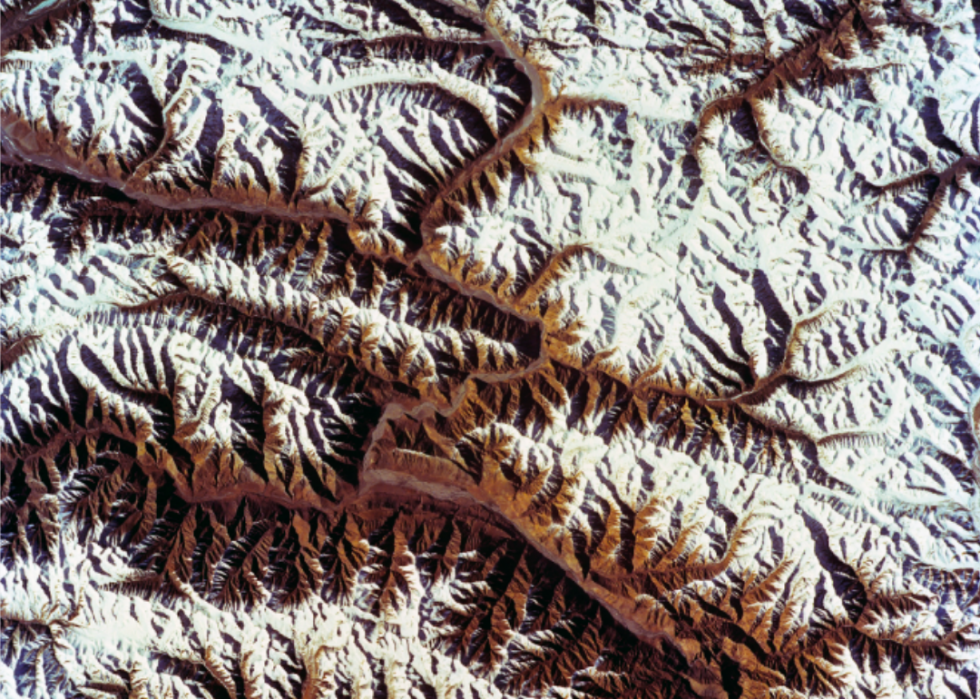
Karakoram Range
Taken from Discovery Orbiter Vehicle 103 in 1993, this image of North India's Karakoram Range showcases some of the tallest mountains on the planet. The borders of several individual countries, including China, Pakistan, and India, all converge within the mountain system. Cutting through the range is the Karakoram Highway, a twisty, dangerous road that reaches elevations of more than 15,000 feet and is considered the highest paved international road in the world.
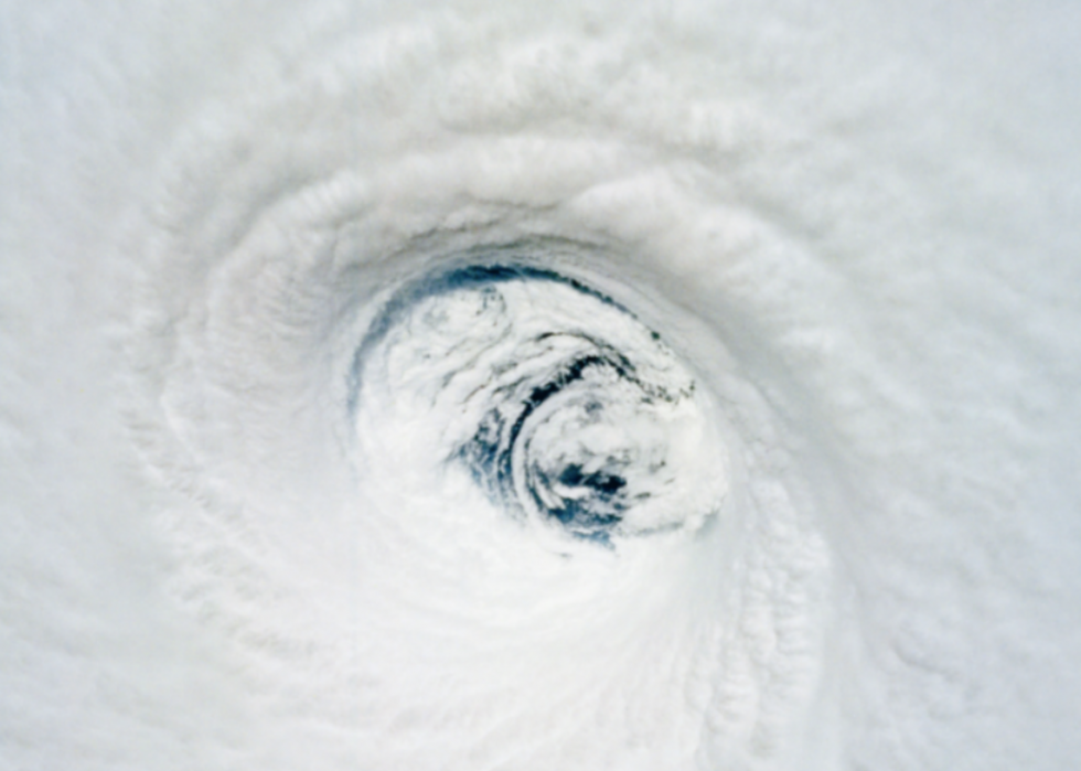
Hurricane Emilia
Captured by the crew of Columbia Orbiter Vehicle 102 in 1994, this image of Hurricane Emilia shows the eye of the storm as it moves toward Hawaii. While the hurricane never landed anywhere, it did create strong surf and wind gusts, which caused some damage to parts of the Hawaiian Islands.
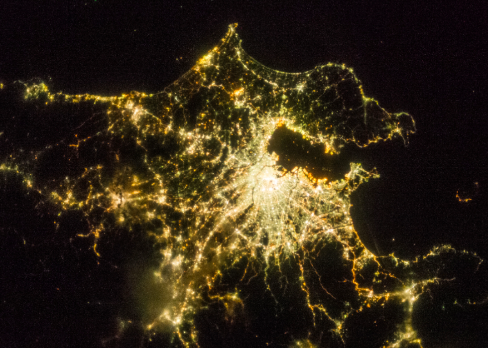
The lights of Tokyo
A crew member of NASA's Expedition 36 snapped this shot of Tokyo during a night pass. The visible bright lights clearly depict Tokyo's dense population of 37 million.
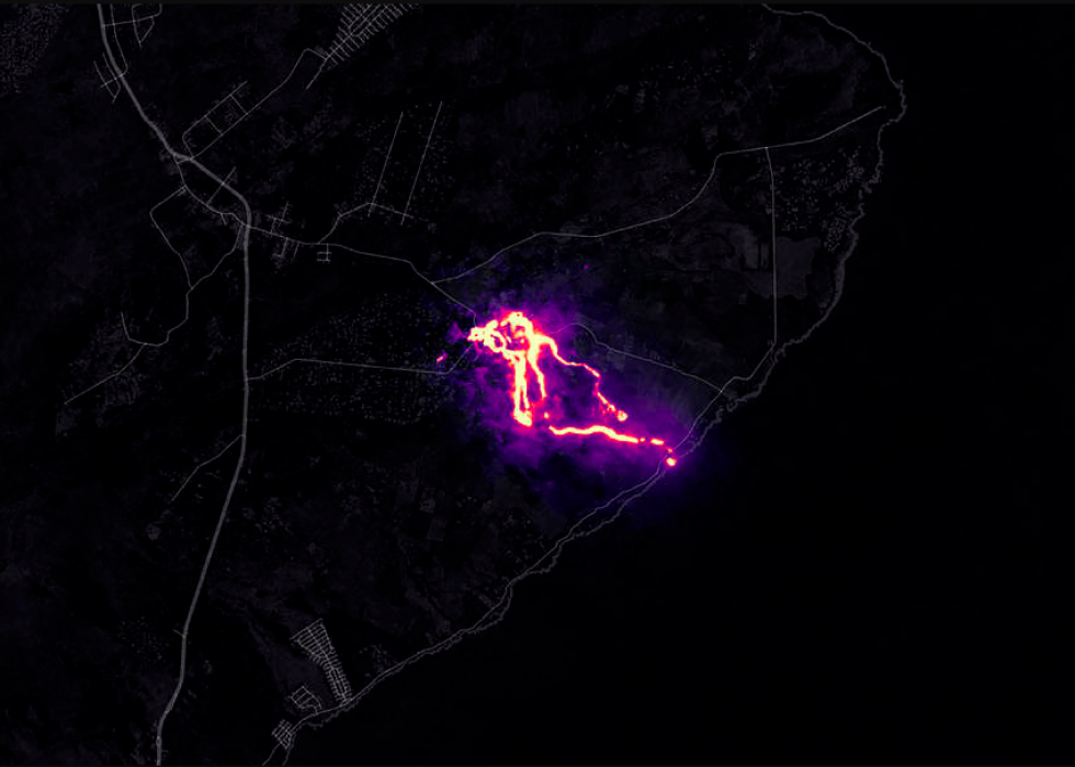
Kilauea Volcano eruption
Causing damage and destruction beyond anything residents had ever seen, Hawaii's Kilauea Volcano erupted in 2018, burying homes and roads in lava and demolishing entire neighborhoods. This image, captured by Operational Land Imager on Landsat 8, shows the eruption using a shortwave of infrared and green light. While the volcano has been erupting continuously since 1983, the 2018 eruption was the largest in 200 years.
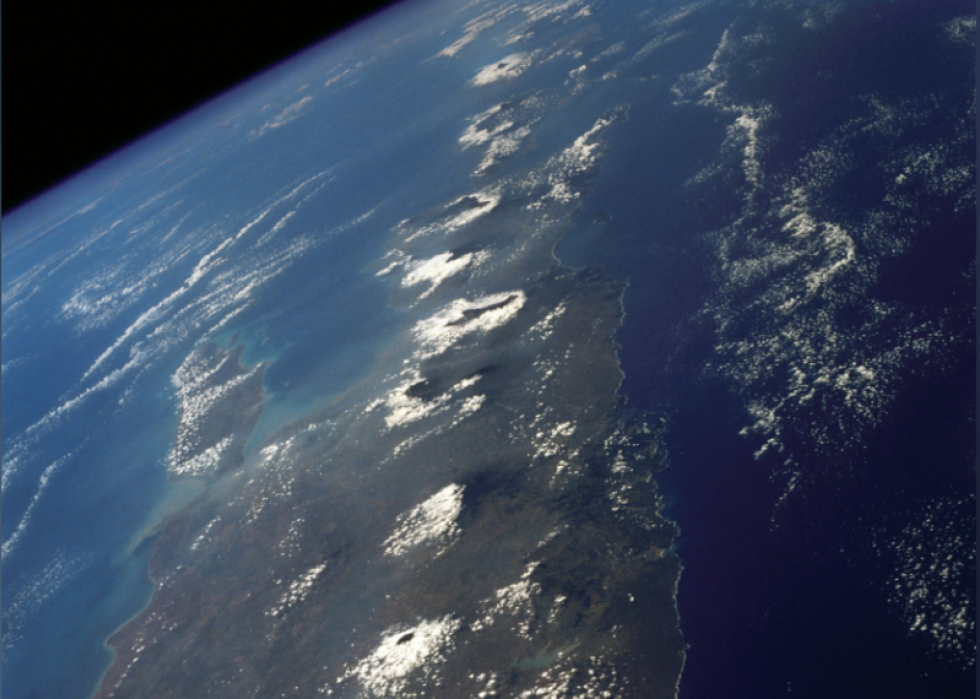
Volcanic craters in Central Java
This symmetrical alignment of volcanic craters in Central Java, Indonesia, was captured by NASA in 1992. Indonesia has approximately 127 active volcanoes and is part of the "Ring of Fire," an area around the edges of the Pacific Ocean with heavy volcanic and earthquake activity. NASA's image shows just some of these craters, with the Indian Ocean and the Java Sea creating a perfect contrast to the line of volcanoes.
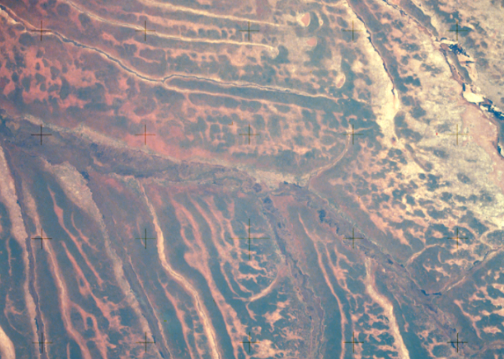
Cuando River
Taken from the Apollo spacecraft during the joint U.S.-USSR Apollo-Soyuz Test Project mission in 1975, this view of the Cuando River in Angola and southwestern Africa shows the unusual patterns created by the river's changing water levels. Angola has a wide range of topographical variations and, despite being affected by severe drought in the 1980s, enjoys a wealth of natural resources.
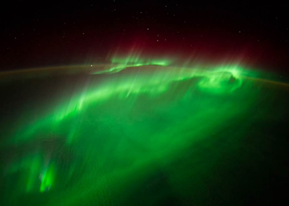
Auroras
While catching a glimpse of Earth's auroras is always amazing, seeing them from space is truly magnificent, as illustrated by this image captured by the Expedition 40 crew aboard the International Space Station in 2014. Auroras, which take place near the North and South Poles, are created by charged particles from the sun striking atoms in Earth's atmosphere, making for light shows that feel almost otherworldly.
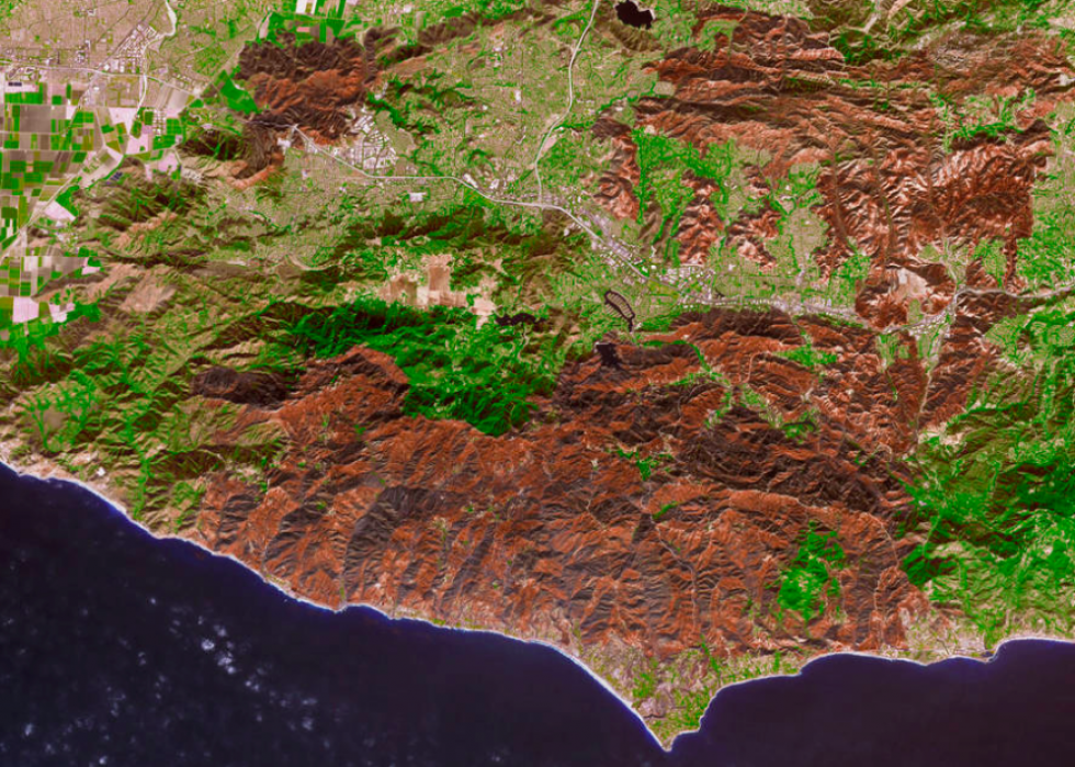
Woolsey Fire's destruction
The Woolsey Fire left California reeling, devastating more than 80% of the Santa Monica Mountains National Recreation Area. This view of the destruction was taken on Nov. 18, 2018, by the Advanced Spaceborne Thermal Emission and Reflection Radiometer (ASTER) on the Terra satellite. The Terra satellite focuses on the exploration of climate and climate change and maps how human activity and natural disasters affect the planet. Enhancements to the image contrast the visual of the burned vegetation with the areas that survived.
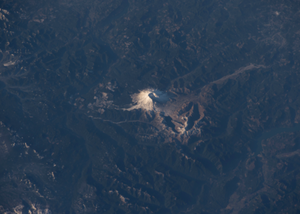
Mount St. Helens
The Expedition 42 crew took this shot of Washington's Mount St. Helens during their time aboard the International Space Station in 2014. The volcano was relatively quiet until a major eruption in 1980, which spewed steam and ash upwards of 6,000 feet into the air. As the volcano continued to erupt over the next several days, it sent out approximately 540 million tons of ash, which drifted more than 2,000 miles and settled across several states.
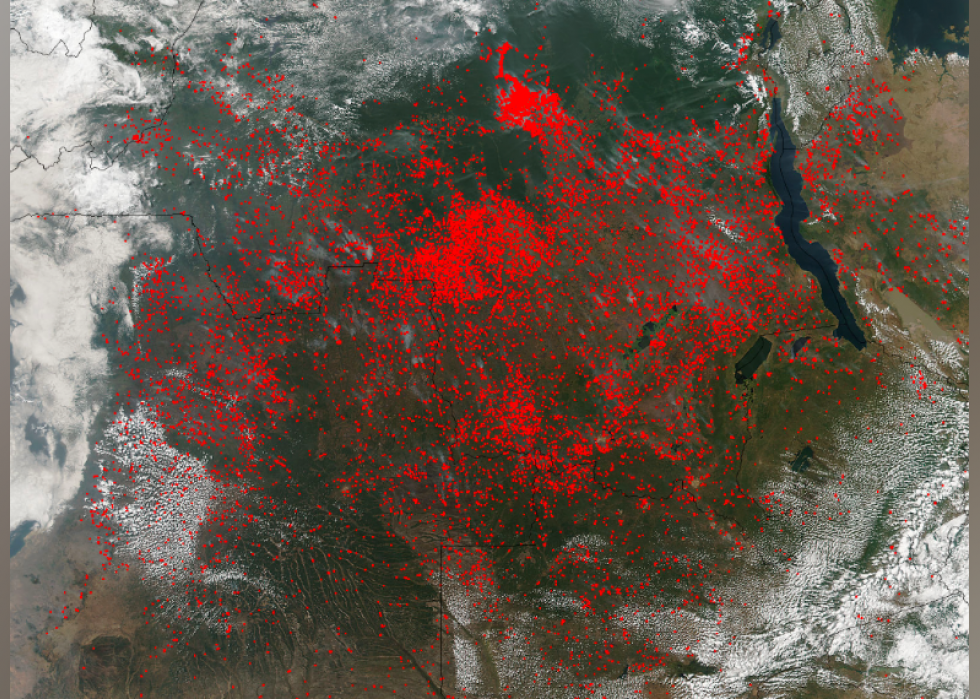
Central African fires
In 2017, the Suomi NPP satellite captured images of fires burning across central Africa, by way of the Visible Infrared Imaging Radiometer Suite. This instrument was able to provide an infrared view of what appeared to be thousands of fires, which were likely set intentionally to burn out vegetation in anticipation of the next growing season.
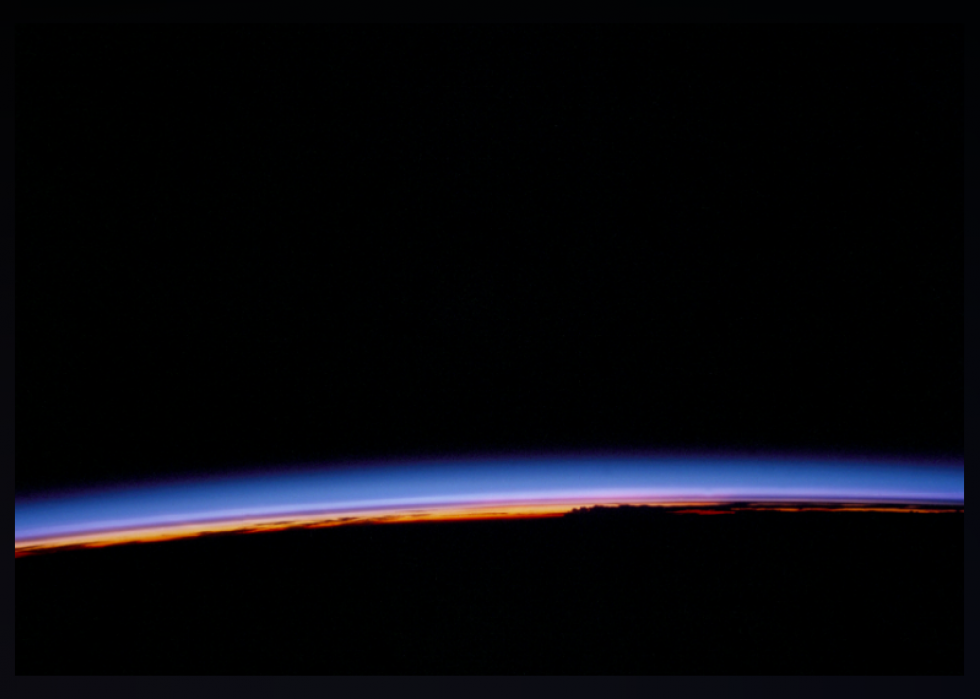
Amazon basin sunset
Photographed from the space shuttle Challenger during its maiden flight in 1983, this view of the sunset over the Amazon basin gives a remarkable view of the edge of the Earth as night approaches. The Challenger made nine successful launches and landings in the 1980s. Sadly, its 10th launch in 1986 caused it to break apart within seconds, which resulted in the death of all crew members on board.
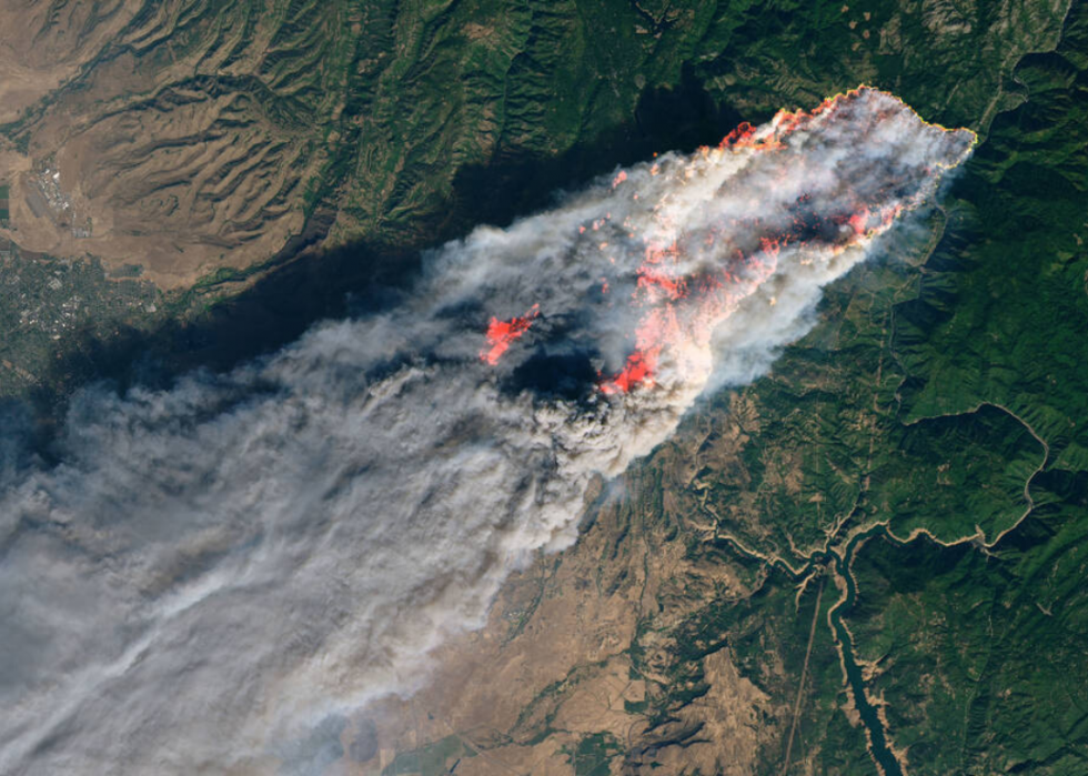
Camp Fire
This satellite image from Nov. 8, 2018, shows the devastation being wrought by California's Camp Fire, one of the worst recorded for that state. Camp Fire wasn't contained until 17 days after this image, on Nov. 25, 2018.
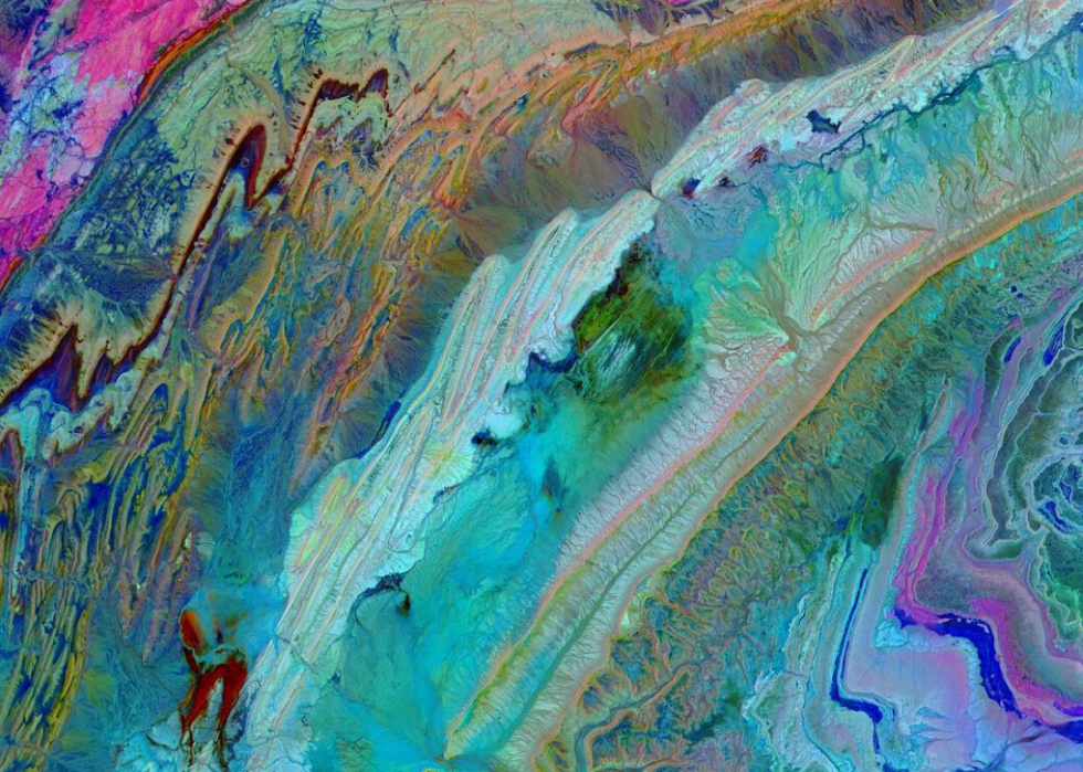
Anti-Atlas Mountains, Morocco
Near-infrared and short wavelength infrared bands draw out the myriad rock types comprising the Anti-Atlas Mountains in Morocco which were formed approximately 80 million years ago when African and Eurasian tectonic plates crashed against each other, pushing claystone, gypsum, limestone, and sandstone from the ocean floor up and creating mountainous peaks.
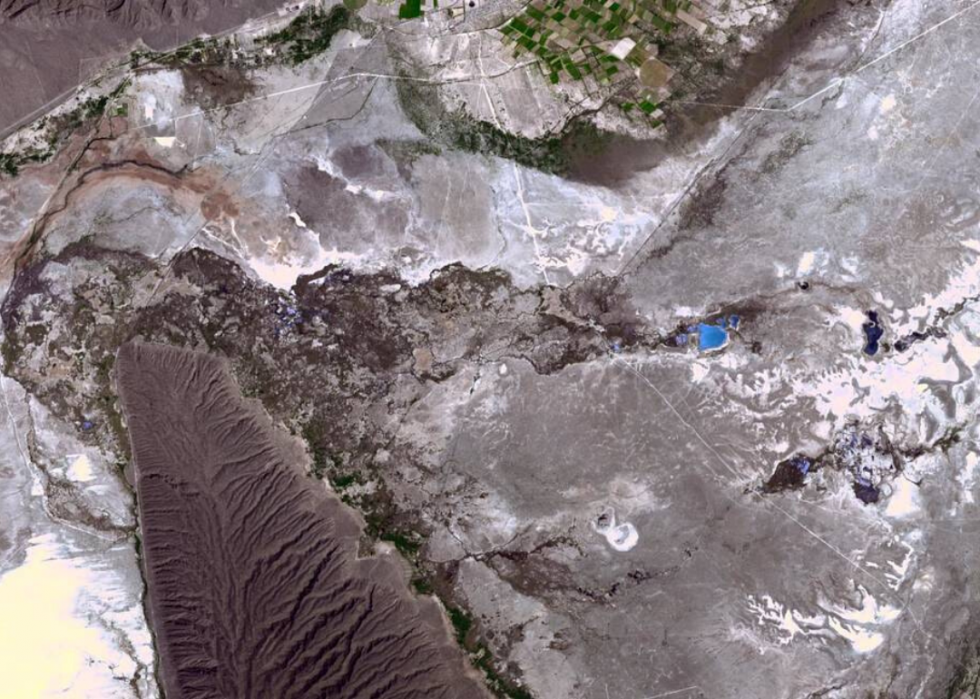
Mexico's Cuatro Cienegas Basin
The Cuatro Cienegas Basin represents an unusual collection of spring-fed pools in Mexico's Chihuahuan Desert. In the pools are living stromatolites, layers of single-celled microbes that are among the earliest life forms on the planet.
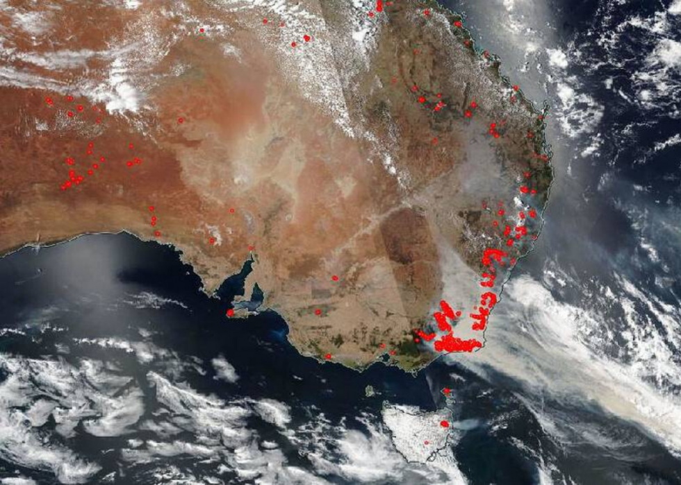
Bushfires in Australia
This image from Jan. 1, 2020, captures the spread of bushfires across parts of Australia as they intensified. At that time, there were 3.67 million acres burning in New South Wales alone.
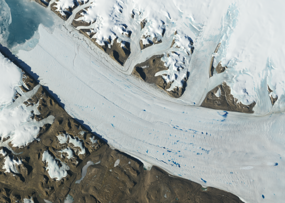
Meltwater lakes in Greenland
Meltwater lakes are more prevalent and found at higher elevations in recent years, and this image of such lakes forming on Greenland's Petermann Glacier is no exception. Images like this allow climate scientists to better understand how once-frozen regions are being changed by global warming.
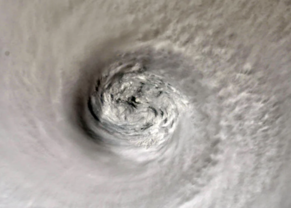
Eye of Hurricane Dorian
Hurricane Dorian caused $3.4 billion in damage to the Bahamas in 2019. Here, you can see the eye of the storm. The image was posted to Twitter on Sept. 2, 2019, by astronaut Nick Hague.
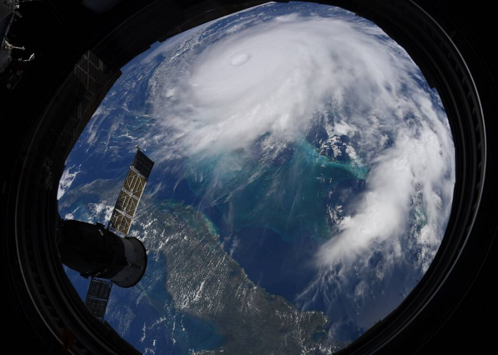
View of Hurricane Dorian from the International Space Station
This image of Hurricane Dorian, also from Sept. 2, 2019, was captured by NASA astronaut Christina Koch during a flyover more than 200 miles from Earth. Part of what made the Category 5 storm so devastating was it's speed: Hurricane Dorian spent three days over the Bahamas, ratcheting up its death toll and damages.
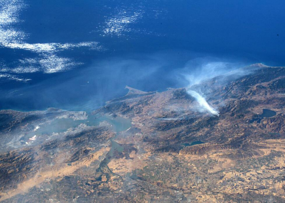
California wildfires
NASA astronaut Andrew Morgan got several images of the California wildfires in early September 2019 while aboard the International Space Station. NASA satellites are often the first to spot wildfires in less-inhabited areas around the world.
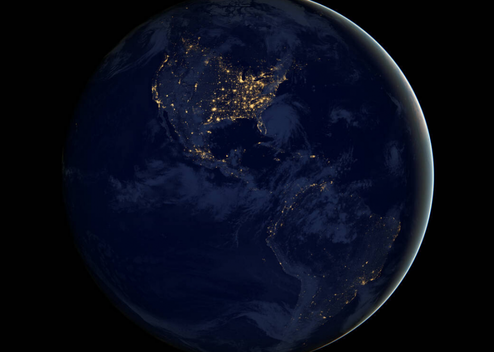
Americas by night
This stunning image of North and South America at night is actually a composite of data from April and October 2012 that was then mapped over Blue Marble images of Earth. The resulting effect was used throughout NASA's ebook "Earth at Night."
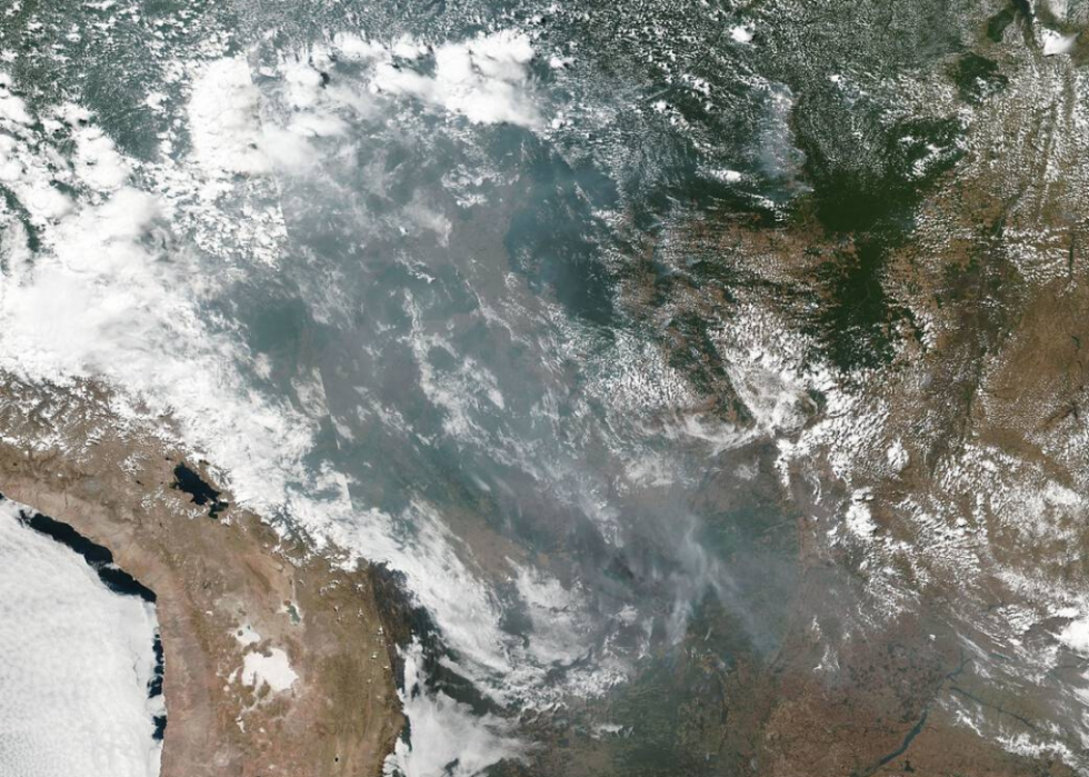
Brazilian rainforest wildfires
This image, showing the spread of fires throughout Brazilian states including Amazonas, Mato Grosso, and Rondônia in Brazil, was captured Aug. 20, 2019, using NOAA/NASA's Suomi NPP with the Visible Infrared Imaging Radiometer Suite. By the end of August, there was a 77% increase in fires in the Amazon over the same time period in 2018, according to data collected by the National Institute for Space Research.
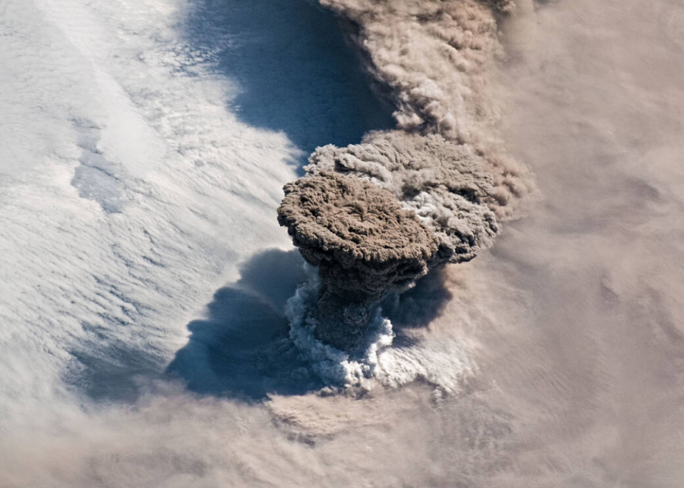
Raikoke eruption
The Raikoke Volcano is located on Russia's Kuril Islands, northeast from Japan and standing between the north Pacific Ocean and Sea of Okhotsk. This eruption from the volcano came on June 22, 2019—almost 100 years after the last eruption in 1924. Astronauts got the shot as the volcano's plume climbed and then spread like an umbrella.
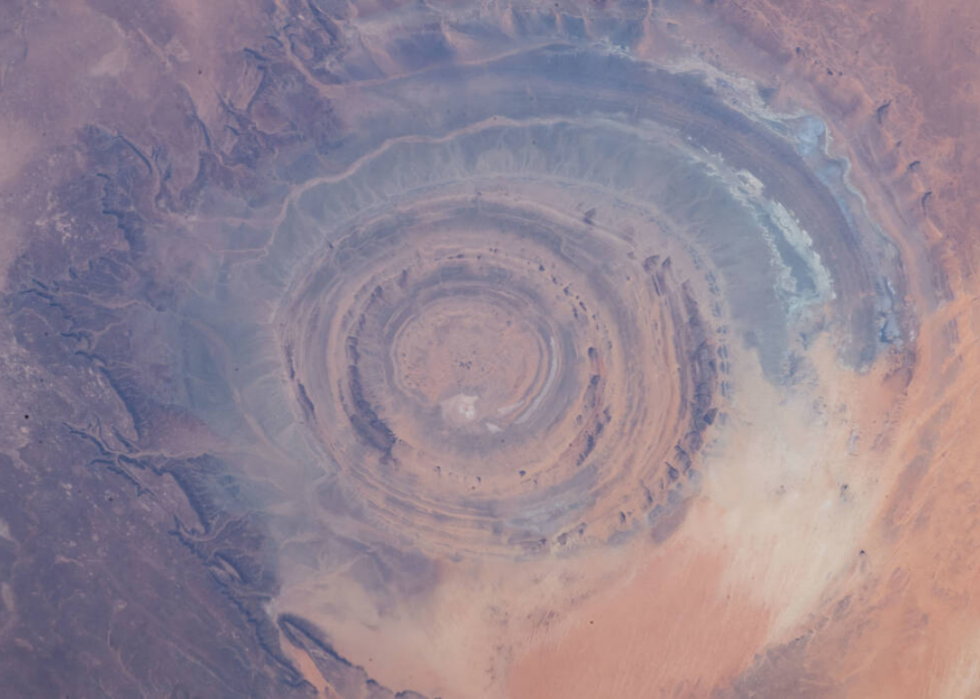
Eye of the Sahara
Taken from 255 miles above sea level in 2019, this image of the Sahara Desert in northwestern Mauritania shows a circular geological phenomenon called a "domed anticline." Erosion over many years has revealed layers of flat rock beneath.
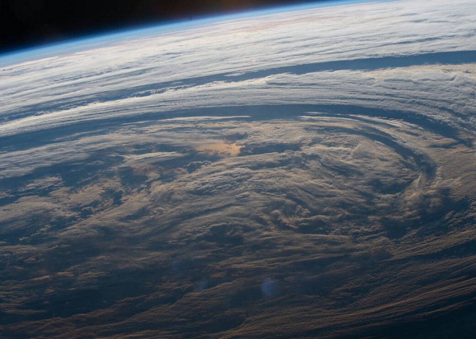
Ocean clouds
This swirling cloud formation over the South Indian Ocean was captured in March 2019 by an astronaut above the International Space Station. Clouds, comprised of water and particles, commonly form in the troposphere, which stretches from sea level to between 4 and 12 miles.
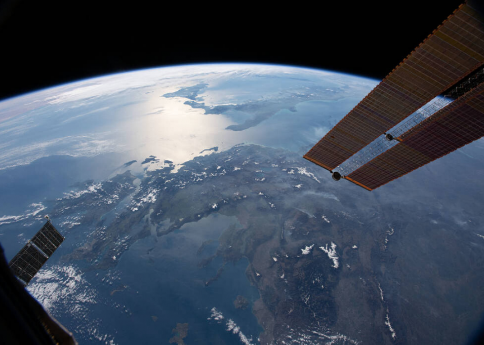
Aerial view of Southern Europe
This view west from the International Space Station shows Greece, Italy's boot, and Sicily in the background. Standing between Italy and Greece is the Ionian Sea, which stretches for 65,251 square miles.
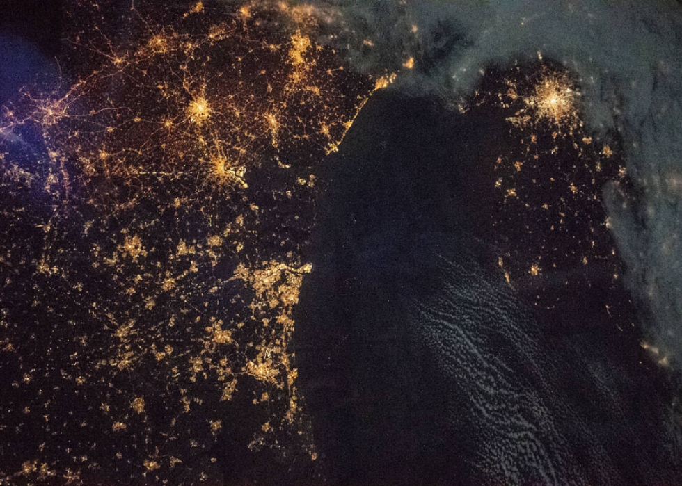
European nightlights
This vantage point of nighttime lights on across Europe is captured in this shot from a vantage point 258 miles above the English Channel. Clockwise from top right are London, Amsterdam, The Hague, Rotterdam, Antwerp, Brussels, and environs.
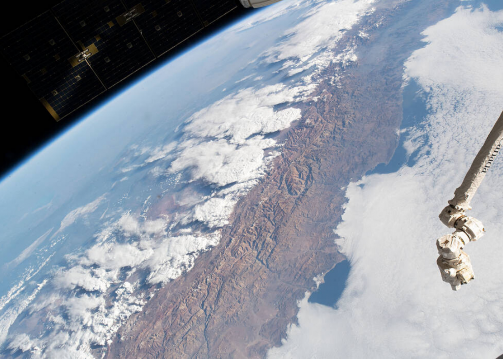
The Andes
The Andes Mountains represent the longest, uninterrupted continental mountain range in the world and the highest range outside Asia. The South American mountains run from north from the Caribbean coast to continent's southern tip and through seven countries. In this 2018 image, you can see clouds over the western coast of Chile.
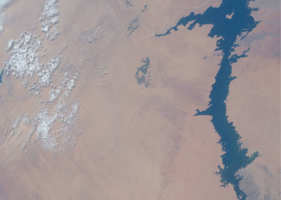
Egypt's Lake Nasser
Lake Nasser is the biggest manmade reservoir in the world, covering 2,027 square miles. To create it, the Aswan High Dam was constructed in the 1960s to capture water from the Nile River. This vantage point of the reservoir is from 251 miles above the ground.
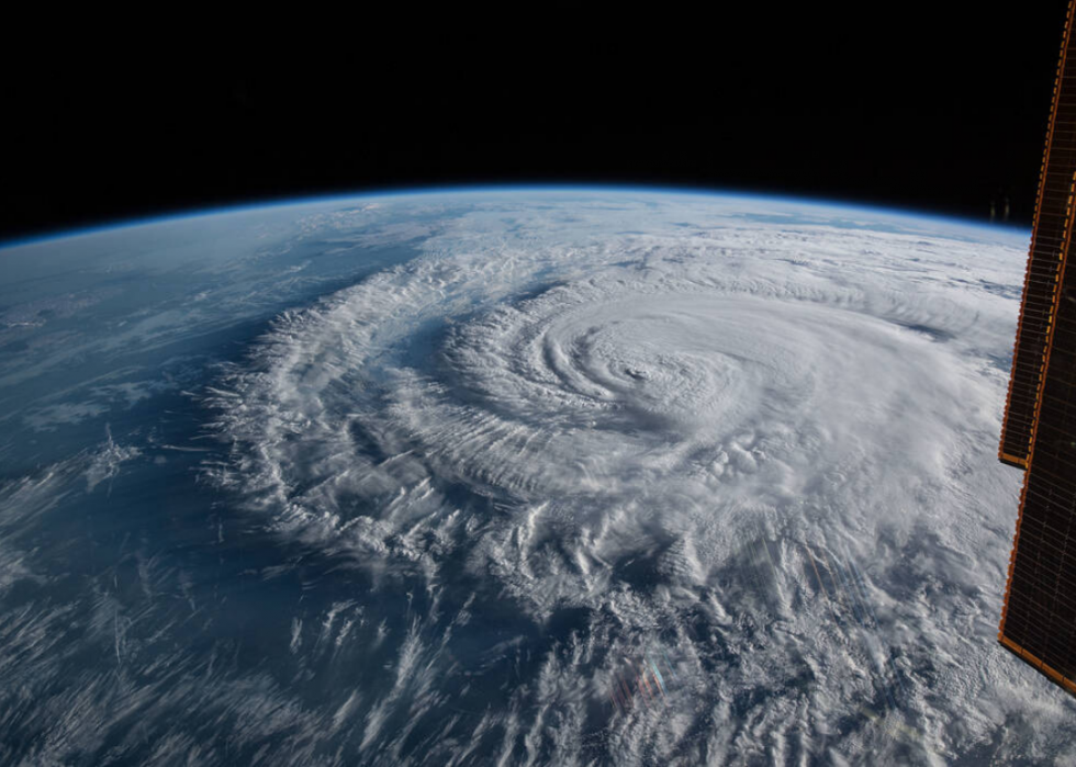
Hurricane Florence
This Sept. 14, 2018, image shows Hurricane Florence making landfall close to Wrightsville Beach in North Carolina. The Category 1 storm caused up to $22 billion in damages.
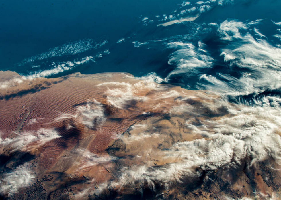
West coast of southern Africa
Clouds and various topographical patterns on land look like brushstrokes in this photo of the west coast of southern Africa. Beyond land, one can see the deep blue of the South Atlantic Ocean.
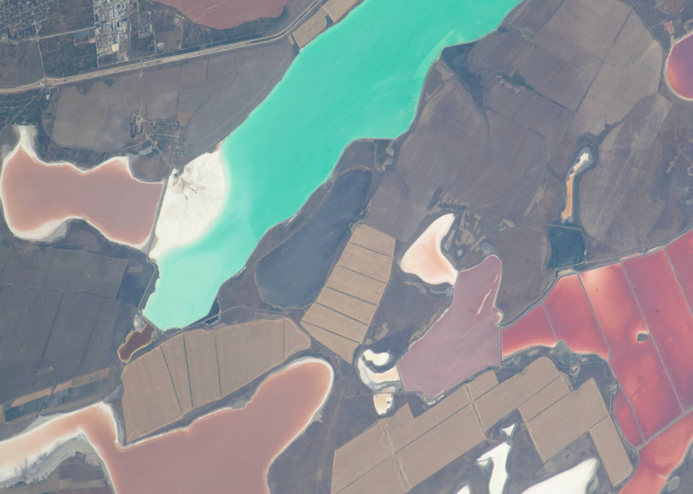
Lagoons between seas
Variously colored, shallow lagoons in the Crimea pictured here in 2018 get their hues from different chemical compositions. The lagoons are situated between the Black Sea and the Sea of Azov.
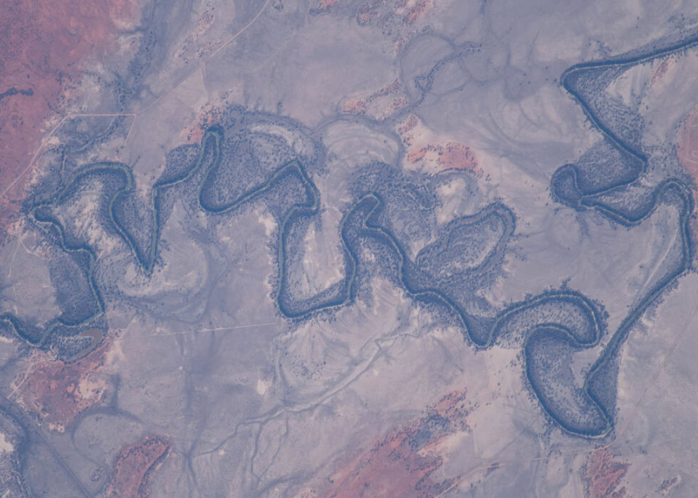
Darling River
Australia's Darling River is the third longest on the continent. This 2018 image captures part of the river as it winds its way through the New South Wales city Wilcannia.


