States with the most land owned by the federal government
States with the most land owned by the federal government
The federal government owns 27.1% of all land in the United States, or 615.3 million of 2.27 billion acres. Federal lands are managed mostly for preservation, recreation, and the development of natural resources.
The Bureau of Land Management (BLM), a governmental division that manages public lands, controls 39.7% of federally owned lands. The Forest Service (FS), in charge of national forests and grasslands, is responsible for 31.4% of federal land. The Fish and Wildlife Service (FWS), which manages 14.5% of public lands, is responsible for restoration and protection efforts related to endangered species, wildlife refuges, fisheries, and migratory birds. The National Park Service (NPS) manages 13% of federal lands, and finally, the Department of Defense (DOD) takes care of 1.4% of government property.
The United States expanded in its early years by acquiring or purchasing land, eventually transferring it to state governments or individuals through homesteading or land grants and encouraging settlers to relocate to the west. But in the 20th century, the government switched gears and started focusing its efforts on retaining the land it owned. Today, a handful of U.S. agencies have land disposal and acquisition authorities, but the federal government's ownership of U.S. land has largely been decreasing. From 1990 to 2018, federal land ownership shrunk by 31.5 million acres.
Much of the land that the federal government owns is concentrated in the western part of the country. In fact, the U.S. government owns about 47% of all land in the West. This is partly due to the fact that a lot of the territory in the western United States is either mountainous or dry and infertile, and wasn't readily snatched up by homesteaders.
Even today, there is a prevailing argument that the federal government should hand its land ownership over to the states, and Congress has even considered passing legislation to do just that. But if the states were to seize control of the federally held land, it would likely impose high administrative costs on the states. On top of that, the federal government gives states money in exchange for the ownership of the land to compensate for taxes that the state might have collected if the land were privately owned.
Stacker compiled a list of the states with the most land owned by the federal government using data from the Congressional Research Service. States are ranked by the percent of land owned by the federal government as of 2018. Data was released Feb. 21, 2020.
Read on to find out who exactly owns what in your state.
#51. Connecticut
- Land owned by federal government: 0.3% (9,110 of 3.1 million acres)
- Land owned by agency: NPS (64.2%), FWS (19.3%), DOD (16.3%), FS (0.3%)
- Percent change since 1990: +34.3%
From 1990 to 2010, the United States government increased the amount of land it owned in Connecticut by 1,774 acres. The state’s only national historic site is Weir Farm, the former home of painter J. Alden Weir from 1882 to 1919.
#50. Iowa
- Land owned by federal government: 0.3% (97,509 of 35.9 million acres)
- Land owned by agency: FWS (75.3%), DOD (21.9%), NPS (2.8%)
- Percent change since 1990: +193.3%
Iowa has just one national historic site: the Herbert Hoover National Historic Site in West Branch, which was the birthplace of the former president. Hoover was born in a two-bedroom cottage in 1874, which is today called the Birthplace Cottage in honor of him.
#49. Kansas
- Land owned by federal government: 0.5% (253,919 of 52.5 million acres)
- Land owned by agency: DOD (45.4%), FS (42.8%), FWS (11.6%), NPS (0.2%), BLM (0%)
- Percent change since 1990: -9.7%
Kansas has one national forest, four national historic sites, and five national historic trails. Cimarron National Grassland in the southwestern region of the state is one of the 20 national grasslands managed by the U.S. Department of Agriculture’s Forest Service. The drought and subsequent dust storms of the 1930s devastated much of the land, and the U.S. government started purchasing it in 1938 for restoration.
#48. Rhode Island
- Land owned by federal government: 0.7% (4,513 of 677,120 acres)
- Land owned by agency: FWS (53.5%), DOD (46.4%), NPS (0.1%)
- Percent change since 1990: +45.1%
Blackstone River Valley is the only national historic park in Rhode Island and commemorates the river’s role in spawning the Age of Industry in the United States. Samuel Slater invented the cotton spinning mill in Pawtucket, Rhode Island, which eventually led to the country’s first textile mill and inspired the establishment of others in the area. The rise of industry transformed the entire region from farmland to factory towns and led to a mass influx of French Canadians from Quebec.
#47. New York
- Land owned by federal government: 0.8% (230,992 of 30.7 million acres)
- Land owned by agency: DOD (65.5%), NPS (14.8%), FWS (12.7%), FS (7.1%)
- Percent change since 1990: +7.2%
New York has just one national forest: the Finger Lakes National Forest, which spans the Seneca and Cayuga Lakes. The property has more than 30 miles of trails and encompasses about 16,212 acres.
#46. Nebraska
- Land owned by federal government: 1.1% (546,852 of 49 million acres)
- Land owned by agency: FS (64.2%), FWS (31.9%), DOD (1.8%), NPS (1.1%), BLM (1%)
- Percent change since 1990: +3.4%
Nebraska has three national monuments, including the popular Agate Fossil Beds and Scotts Bluff. The Agate Fossil Beds were once home to the Lakota Sioux; in the 1890s, scientists flocked to the area and eventually discovered one of the world’s most important Miocene Epoch mammal sites, already well known among the Lakota Sioux. Scotts Bluff is a 3,000-acre property that also has paleontological roots, and was a spot along the Oregon Trail.
#45. Illinois
- Land owned by federal government: 1.2% (423,782 of 35.8 million acres)
- Land owned by agency: FS (71.9%), FWS (21.2%), DOD (6.9%), BLM (0%), NPS (0%)
- Percent change since 1990: +20%
Illinois is home to one national historic site and one national monument: the Lincoln Home National Historic Site and the Pullman National Monument. The latter, in northern Illinois, commemorates what the first planned industrial community in the United States and was home to the famously violent Pullman strike in 1894.
#44. Massachusetts
- Land owned by federal government: 1.2% (62,680 of 5 million acres)
- Land owned by agency: NPS (53.2%), FWS (37.2%), DOD (9.6%)
- Percent change since 1990: -1%
Massachusetts has a number of national historic sites and parks in addition to a national seashore. The 40 miles of outer beach on Cape Cod is federally protected due to its diverse species and habitats. Minute Man National Historic Park (which includes the pictured Hartwell Tavern) served as the location for the opening battle of the American Revolutionary War; visitors today can check out the battlefield and wartime structures.
#43. Ohio
- Land owned by federal government: 1.2% (305,502 of 26.2 million acres)
- Land owned by agency: FS (80%), DOD (10.4%), NPS (6.6%), FWS (3%)
- Percent change since 1990: +30.3%
The Cuyahoga Valley National Park in Ohio was established in October 2000 and is the state's only national park. Its history, however, goes back to 1974 when the government created a national recreation area in the Cuyahoga River Valley.
#42. Maine
- Land owned by federal government: 1.5% (301,481 of 19.8 million acres)
- Land owned by agency: NPS (51.8%), FWS (24.4%), FS (17.9%), DOD (6%)
- Percent change since 1990: +70.8%
The National Park Service turned 100 in 2016. In honor of the milestone, American businesswoman Roxanne Quimby donated almost 90,000 acres of land that she owned east of Baxter State Park in Maine to the federal government, as well as a $40 million endowment to maintain the land. Susan Sharon of Maine Public Radio reported at the time that Quimby had worked for two decades to make a national monument or park in the North Woods.
#41. Oklahoma
- Land owned by federal government: 1.5% (683,289 of 44.1 million acres)
- Land owned by agency: FS (58.5%), DOD (24%), FWS (15.8%), NPS (1.5%), BLM (0.3%)
- Percent change since 1990: +35.1%
Oklahoma is home to two national historic sites, the Washita Battlefield and Fort Smith. The former commemorates a surprise attack on a Cheyenne village during the Great Plains War. The first iteration of Fort Smith stood from 1817 to 1824, and the second from 1872 to 1896 when a federal judge’s reign over the “Indian Territory,” present-day Oklahoma, ended.
#40. Indiana
- Land owned by federal government: 1.7% (384,726 of 23.2 million acres)
- Land owned by agency: FS (53.1%), DOD (39.7%), FWS (4.4%), NPS (2.8%)
- Percent change since 1990: +40.2%
Indiana Dunes, the state’s sole national park, spans more than 15,000 acres that include 15 miles of shoreline along Lake Michigan. The park is home to more than 1,100 native plants, making it the seventh-most diverse spot for plants of all the National Park Service sites.
#39. Texas
- Land owned by federal government: 1.9% (3.2 million of 168.2 million acres)
- Land owned by agency: NPS (37.3%), FS (23.4%), DOD (21.1%), FWS (17.8%), BLM (0.4%)
- Percent change since 1990: +21.9%
Texas’ national parks and monuments are immensely popular: 3.4 million people visited the state’s national parks and monuments in 2013. Those visits generated $173.4 million in visitor spending.
#38. Pennsylvania
- Land owned by federal government: 2.2% (622,160 of 28.8 million acres)
- Land owned by agency: FS (82.6%), NPS (8.6%), DOD (6.8%), FWS (2%)
- Percent change since 1990: +1.8%
Gettysburg National Military Park in Pennsylvania is the site of the Battle of Gettysburg, the bloodiest battle of the Civil War. That battle, fought July 1-3, 1863, represented a major turning point and inspired President Abraham Lincoln’s famous “Gettysburg Address.”
#37. Delaware
- Land owned by federal government: 2.4% (29,918 of 1.3 million acres)
- Land owned by agency: FWS (85.4%), DOD (11.6%), NPS (3%)
- Percent change since 1990: +7.9%
As the first state to ratify the U.S. Constitution, Delaware is home to First State National Park, comprised of seven locations around the state. The most famous of these sites is The Green in Dover, which is most well known as the site where the U.S. Constitution was ratified to mark Delaware as the first state.
#36. Alabama
- Land owned by federal government: 2.7% (880,188 of 32.7 million acres)
- Land owned by agency: FS (76.2%), DOD (17.7%), FWS (3.7%), NPS (2%), BLM (0.3%)
- Percent change since 1990: -6.8%
Alabama is home to a number of national monuments, parks, preserves, and other landmarks. As of 2013, there were 138 active oil and gas drilling leases spanning about 75,390 acres in Alabama.
#35. Maryland
- Land owned by federal government: 3.2% (205,362 of 6.3 million acres)
- Land owned by agency: DOD (55.3%), FWS (24.2%), NPS (20.2%), BLM (0.3%)
- Percent change since 1990: +18.2%
Maryland has various national parks and monuments as well as a national seashore. Assateague Island National Seashore stretches for more than 48,000 acres that as far back as the 1600s were used by settlers for grazing horses and livestock. Today, Assateague Island is still home to wild horses, which are the descendants of the original colonists’ horses.
#34. New Jersey
- Land owned by federal government: 3.6% (171,956 of 4.8 million acres)
- Land owned by agency: FWS (42.9%), DOD (36.3%), NPS (20.8%)
- Percent change since 1990: +17.4%
New Jersey’s 12 national park sites, along with its trails and historic regions, brought in 5.3 million visitors in 2018. One of the most famous national park sites in New Jersey is Ellis Island, which was the gateway for over 12 million immigrants coming to the United States.
#33. Missouri
- Land owned by federal government: 3.8% (1.7 million of 44.2 million acres)
- Land owned by agency: FS (88.5%), DOD (4.6%), FWS (3.6%), NPS (3.2%), BLM (0%)
- Percent change since 1990: +2.2%
Missouri’s most famous landmark, the Gateway Arch, is also a national park. The metallic arch is supposed to represent the city of St. Louis’ role in facilitating the country’s Westward expansion. The Gateway Arch National Park is dedicated to Thomas Jefferson, who oversaw the Louisiana Purchase, and Dred Scott, a former slave who sued for his freedom and died in St. Louis.
#32. North Dakota
- Land owned by federal government: 3.9% (1.7 million of 44.5 million acres)
- Land owned by agency: FS (63.6%), FWS (28.2%), NPS (4.1%), BLM (3.3%), DOD (0.7%)
- Percent change since 1990: +0.4%
North Dakota's national parks attracted 572,475 visitors in 2013, and contributed $34.3 million in visitor spending. In 2013, there were also 2,061 active oil and gas drilling leases in North Dakota and 255 new approved leases. Pictured is the Fort Union Trading Post National Historic Site in Williston.
#31. Kentucky
- Land owned by federal government: 4.3% (1.1 million of 25.5 million acres)
- Land owned by agency: FS (74.4%), DOD (16%), NPS (8.6%), FWS (1.1%)
- Percent change since 1990: +13.8%
Kentucky has two historical parks and two historical trails, but in addition to its rich role in U.S. history, Kentucky has also preserved a unique geological feature thanks to federal protection. Mammoth Cave National Park represents the planet’s longest known cave system, at more than 400 miles. That park also serves to preserve around 53,000 forested acres.
#30. South Carolina
- Land owned by federal government: 4.5% (875,316 of 19.4 million acres)
- Land owned by agency: FS (72.5%), FWS (14.9%), DOD (8.9%), NPS (3.7%)
- Percent change since 1990: -1.8%
South Carolina’s Congaree National Park is the largest intact expanse of old-growth, bottomland hardwood forest in the southeastern United States. The park’s official designation in 2003 was the result of decades of work begun in 1969 to protect the area from excessive harvesting and exploitation of its trees.
#29. Louisiana
- Land owned by federal government: 4.7% (1.4 million of 28.9 million acres)
- Land owned by agency: FS (45%), FWS (43%), DOD (10.5%), NPS (1.3%), BLM (0.2%)
- Percent change since 1990: -14.2%
The federal government’s land ownership in Louisiana actually decreased from 1990 to 2010 by 247,723 acres. Louisiana’s five national park service units, national monument, national forest, and three wilderness areas drew 624,046 visitors in 2013 and generated $34.4 million in visitor spending.
#28. Tennessee
- Land owned by federal government: 4.8% (1.3 million of 26.7 million acres)
- Land owned by agency: FS (56.4%), NPS (28%), DOD (11.4%), FWS (4.2%)
- Percent change since 1990: +30.7%
Much of the federal government’s property in Tennessee is also dedicated to preserving history: There are 1,656 archaeological sites in the state’s national parks, and 35 threatened or endangered species. To help with preservation efforts, the state has earned $37,805,188 in historic preservation grants since 1969.
#27. Mississippi
- Land owned by federal government: 5.1% (1.6 million of 30.2 million acres)
- Land owned by agency: FS (76.7%), FWS (13.6%), NPS (6.7%), DOD (2.6%), BLM (0.3%)
- Percent change since 1990: +5%
There are eight national parks in Mississippi: Brices Cross Roads National Battlefield Site, Gulf Islands National Seashore, Natchez National Historical Park, Natchez Trace Parkway, Natchez Trace National Scenic Trail, Shiloh National Military Park, Tupelo National Battlefield (pictured), and Vicksburg National Military Park. The last is shared with Louisiana and commemorates where the Battle of Vicksburg was fought in 1863 during the Civil War.
#26. Georgia
- Land owned by federal government: 5.2% (1.9 million of 37.3 million acres)
- Land owned by agency: FS (44.6%), DOD (28.3%), FWS (25.1%), NPS (2.1%)
- Percent change since 1990: +1.3%
Georgia has 11 national parks, including the Ocmulgee Mounds National Historical Park that has been inhabited by humans for around 17,000 years. People were thought to have first come to the region during the Ice Age for hunting. Around the year 900, the Mississippian Period people constructed mounds for their elite, which remain standing at the park today.
#25. Wisconsin
- Land owned by federal government: 5.3% (1.9 million of 35 million acres)
- Land owned by agency: FS (82.2%), FWS (10.9%), DOD (3.4%), NPS (3.3%), BLM (0.1%)
- Percent change since 1990: -6.4%
Almost 20% of land in Wisconsin is owned by the federal, state, or county government. Much of the land owned by the federal government there is comprised of the 1.5-million-acre Chequamegon-Nicolet National Forest.
#24. South Dakota
- Land owned by federal government: 5.4% (2.6 million of 48.9 million acres)
- Land owned by agency: FS (76%), BLM (10.4%), FWS (7.8%), NPS (5.6%), DOD (0.1%)
- Percent change since 1990: +0.5%
South Dakota has more than 1,000 waterfowl production areas totaling more than 150,000 acres managed by the U.S. Fish and Wildlife Service as satellite stations to the National Wildlife Refuge System. The U.S. Forest Service also oversees more than 2 million acres open to hunting in the state. Much of that land can be found in Black Hills National Forest, but is also present in Custer National Forest, Buffalo Gap, Fort Pierre, and Grand River national grasslands.
#23. Minnesota
- Land owned by federal government: 6.8% (3.5 million of 51.2 million acres)
- Land owned by agency: FS (81.2%), FWS (14.7%), NPS (4%), DOD (0.1%), BLM (0%)
- Percent change since 1990: -1.2%
About 75% of the land in Minnesota is owned by individuals and businesses, while the rest is owned by units of government. The federal government owns both the Superior National Forest and the Chippewa National Forest (pictured), as well as 11 Native American reservations. However, most of the land in Minnesota has at one time or another been owned by the federal government, acquired through treaties between the government and foreign nations, or between the government and Native American tribes.
#22. West Virginia
- Land owned by federal government: 7.4% (1.1 million of 15.4 million acres)
- Land owned by agency: FS (92.3%), NPS (5.8%), FWS (1.8%), DOD (0.2%)
- Percent change since 1990: +6.7%
As industrialization took over in the United States in the late 1800s, the demand for land increased rapidly—especially as the timber and mining industries grew and required large amounts of land. In West Virginia, six national parks and the Monongahela National Forest were preserved in order to prevent exploitation and overuse.
#21. North Carolina
- Land owned by federal government: 7.8% (2.4 million of 31.4 million acres)
- Land owned by agency: FS (51.6%), FWS (17.4%), DOD (15.9%), NPS (15.1%)
- Percent change since 1990: +6.3%
Although federal government-owned land is found in almost half of the counties in North Carolina, the majority of that land is concentrated in the western region of the state. The top five counties in North Carolina with the most federal land are Cherokee, Graham, Haywood, Macon, and Swain, representing around 720,000 acres of federally owned land.
#20. Vermont
- Land owned by federal government: 7.8% (465,888 of 5.9 million acres)
- Land owned by agency: FS (88.1%), FWS (7.3%), DOD (2.4%), NPS (2.1%)
- Percent change since 1990: +34.4%
More than 800,000 acres of land in Vermont are owned by federal or state government. Federal lands there include Silvio O. Conte National Fish and Wildlife Refuge, Missisquoi National Wildlife Refuge, and the Green Mountain National Forest (pictured), which comprises more than 400,000 acres.
#19. Virginia
- Land owned by federal government: 9.3% (2.4 million of 25.5 million acres)
- Land owned by agency: FS (70.3%), NPS (12.9%), DOD (11.2%), FWS (5.6%), BLM (0%)
- Percent change since 1990: +2.3%
Starting in 2017, the state of Virginia observes the last Saturday in September as Public Lands Day, a chance to commemorate the contribution of public lands to the state’s heritage, culture, and economy. Virginia has more than 2.3 million acres of national parks—including Shenandoah pictured above—and 41 wildlife management areas.
#18. Arkansas
- Land owned by federal government: 9.4% (3.2 million of 33.6 million acres)
- Land owned by agency: FS (82.1%), FWS (12%), NPS (3.1%), DOD (2.8%), BLM (0%)
- Percent change since 1990: +0.4%
Arkansas has seven National Park Service units, two national forests, 12 wilderness areas, four national historic sites, and one national historic trail. In 2013, 2.77 million visitors went to Arkansas’ national parks and monuments (like Buffalo National River seen here) contributing about $144.3 million in visitor spending.
#17. Michigan
- Land owned by federal government: 10% (3.6 million of 36.5 million acres)
- Land owned by agency: FS (79%), NPS (17.4%), FWS (3.2%), DOD (0.3%), BLM (0%)
- Percent change since 1990: -0.3%
Michigan is home to more federal land than any other individual Midwestern state. The National Park Service, the U.S. Forest Service, the U.S. Fish and Wildlife Service, the Defense Department, and the Bureau of Indian Affairs all own land throughout the state.
#16. Florida
- Land owned by federal government: 12.9% (4.5 million of 34.7 million acres)
- Land owned by agency: NPS (55%), FS (26.8%), DOD (11.6%), FWS (6.5%), BLM (0%)
- Percent change since 1990: +3.4%
Most of the federally owned land in Florida is in the Everglades, Big Cypress National Park, and Dry Tortugas Park. Meanwhile, the state owns roughly 14.2% of the land area in Florida, while local governments own more than half a million acres of land. In January 2020, Florida Gov. Ron DeSantis announced the state would buy 20,000 acres of land in the Everglades to prevent drilling in the area.
#15. New Hampshire
- Land owned by federal government: 14% (805,472 of 5.8 million acres)
- Land owned by agency: FS (93.6%), FWS (4.3%), NPS (1.7%), DOD (0.4%)
- Percent change since 1990: +9.7%
In 1935, the state of New Hampshire passed a law limiting the federal government to owning only 2% of the state’s land. Federal conservation agencies want to increase wildlife refuges, and the state’s legislature passed a 2016 bill to expand the law within the 2% cap. A rough, mountainous 161-mile stretch of the 2,180-plus-mile Appalachian National Scenic Trail (that runs through 13 other states) is located in New Hampshire’s White Mountain National Forest. The Saint-Gaudens National Historical Park, the only other national park in the state, includes the home of American sculptor Augustus Saint-Gaudens, where he lived from 1885–1907; some of his bronze sculpted artwork; and wooded trails.
#14. Hawaii
- Land owned by federal government: 20.2% (829,830 of 4.1 million acres)
- Land owned by agency: NPS (43.2%), FWS (37.3%), DOD (19.5%)
- Percent change since 1990: +16%
The state of Hawaii owns the majority of its 1,376,000 acres of land, followed by the federal government, which owns 531,000 acres, including all of Hawaii’s national parks (like Haleakala pictured here) and military bases. Other top landowners in Hawaii include Haleakala Ranch on Maui, Grove Farm on the island of Kauai, Molokai Ranch, and land developer Alexander & Baldwin.
#13. District of Columbia
- Land owned by federal government: 24.7% (9,649 of 39,040 acres)
- Land owned by agency: NPS (87.8%), DOD (12.2%), BLM (0%)
- Percent change since 1990: +1.2%
Many parts of Washington D.C. are under federal jurisdiction, including national parks and military property, and comprise roughly 29% of the city’s total land area, or 18 square miles. This proved complicated when D.C. legalized marijuana in 2015: Because marijuana is still illegal federally, law enforcement officers can still arrest people in possession of marijuana if they are found with it in sections of D.C. owned by the federal government.
#12. Washington
- Land owned by federal government: 28.6% (12.2 million of 42.7 million acres)
- Land owned by agency: FS (76.6%), NPS (15%), BLM (3.6%), DOD (3.5%), FWS (1.3%)
- Percent change since 1990: +1.7%
Washington has 15 national parks and one national trail managed by the National Park Service. In 2013, these attractions brought in 7.3 million visitors, generating $430.8 million in visitor spending. Olympic National Forest, Colville National Forest, and Gifford Pinchot National Forest are all found in Washington.
#11. Montana
- Land owned by federal government: 29% (27.1 million of 93.3 million acres)
- Land owned by agency: FS (63.5%), BLM (29.6%), NPS (4.5%), FWS (2.4%), DOD (0%)
- Percent change since 1990: +1.3%
The Homestead Act of 1862 dramatically cut the federal government’s land ownership in Montana; throughout the lifetime of the law, more than one-third of the land in Montana was privately acquired. In 1982, 28.5% of Montana’s land was owned by the federal government—just half of a percentage point change from the current standing. Pictured is Avalanche Lake in Glacier National Park.
#10. New Mexico
- Land owned by federal government: 31.7% (24.7 million of 77.8 million acres)
- Land owned by agency: BLM (54.7%), FS (37.4%), DOD (4.6%), NPS (1.9%), FWS (1.3%)
- Percent change since 1990: -0.3%
There has long been a call within New Mexico to transfer some of the federal government’s land ownership to the state. Opponents argue this would mean New Mexico taking responsibility for fire suppression efforts for an additional 22 million-plus acres of land, which would cost about $86 million. People also argue that recreational activity, such as hunting and camping, is more restricted on state-owned land than on federal land. White Sands National Park is seen here.
#9. Colorado
- Land owned by federal government: 36.2% (24.1 million of 66.5 million acres)
- Land owned by agency: FS (60.1%), BLM (34.7%), NPS (2.8%), DOD (1.7%), FWS (0.7%)
- Percent change since 1990: +2.2%
The federal government owns a little more than a third of Colorado’s 67 million acres. Most of this space is open to the public for recreation, but 269,000 acres of public land were deemed “landlocked” by private land. Pictured is Cliff Palace in Mesa Verde National Park.
#8. Arizona
- Land owned by federal government: 38.6% (28.1 million of 72.7 million acres)
- Land owned by agency: BLM (43.2%), FS (39.8%), NPS (9.5%), FWS (6%), DOD (1.6%)
- Percent change since 1990: -18.4%
Only about 18% of the land in Arizona is privately held, with the rest belonging to federal, state, local, and tribal governments. Arizona has 18 national parks and monuments, including the famous 1.2 million-acre Grand Canyon National Park. The Defense Department also owns nearly 3 million acres, mostly on large military bases in the southwestern region of the state.
#7. California
- Land owned by federal government: 45.4% (45.5 million of 100.2 million acres)
- Land owned by agency: FS (45.7%), BLM (33.2%), NPS (16.7%), DOD (3.7%), FWS (0.7%)
- Percent change since 1990: -1.5%
California's government tried in 2017 to pass a law limiting the U.S. government's ability to sell federal land to private companies. Proponents hoped that it would prevent the Trump administration from selling land that could be used for extraction or property development; a federal judge struck down the law in 2018, calling it unconstitutional.
#6. Wyoming
- Land owned by federal government: 46.7% (29.1 million of 62.3 million acres)
- Land owned by agency: BLM (60%), FS (31.6%), NPS (8.1%), FWS (0.2%), DOD (0%)
- Percent change since 1990: -3.3%
The federal ownership of Wyoming’s land has helped to protect some of the country’s best natural treasures. Some of the most well-known national parks in the world, like Yellowstone National Park (pictured) and Grand Teton National Park, are located in Wyoming. Those parks and others have brought an influx of tourism to the country’s least-populated state.
#5. Oregon
- Land owned by federal government: 52.3% (32.2 million of 61.6 million acres)
- Land owned by agency: BLM (48.8%), FS (48.7%), FWS (1.8%), NPS (0.6%), DOD (0.1%)
- Percent change since 1990: +0.6%
Oregon’s history of federal land ownership dates back to 1934 when the Taylor Grazing Act was passed to establish the U.S. Grazing Service. That department was created to oversee federal rangelands organized into grazing districts, mostly found in the eastern two-thirds of Oregon. Today, the Bureau of Land Management manages a dozen wild and scenic rivers, wilderness areas, and wild horse herd management areas. Crater Lake National Park in the Cascade Mountains is seen here.
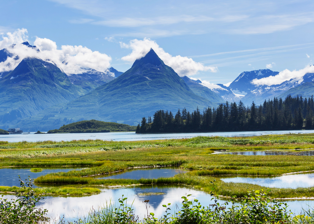
#4. Alaska
- Land owned by federal government: 60.9% (222.7 million of 365.5 million acres)
- Land owned by agency: FWS (34.4%), BLM (32.1%), NPS (23.6%), FS (9.9%), DOD (0%)
- Percent change since 1990: -9.4%
When Alaska became a state in 1959, the federal government gave it 28% ownership of its land. Congress in 1971 passed the Alaska Native Claims Settlement Act, which gave 44 million acres to local villages and natives. However, the federal government remains the largest landowner in Alaska today, and more than a dozen federal agencies oversee Alaska’s federal lands, which include national parks (like Kenai Fjords seen here), wildlife refuges, national forests, military installations, and the North Slope National Petroleum Reserve.
#3. Idaho
- Land owned by federal government: 61.9% (32.8 million of 52.9 million acres)
- Land owned by agency: FS (62.4%), BLM (35.9%), NPS (1.6%), FWS (0.2%), DOD (0%)
- Percent change since 1990: +0.7%
About 14% of the public land in Idaho has been protected with a wilderness designation and is off-limits to mining and timber harvesting. Most of Idaho’s public land is managed under a multiple-use mandate, meaning that the land can be used for multiple activities such as hunting or camping at once. Former Idaho Gov. Cecil Andrus once referred to the state’s public land as “our second paycheck.”
#2. Utah
- Land owned by federal government: 63.1% (33.3 million of 52.7 million acres)
- Land owned by agency: BLM (68.5%), FS (24.6%), NPS (6.3%), FWS (0.3%), DOD (0.2%)
- Percent change since 1990: -0.9%
In Utah, 3.4 million acres of School and Institutional Trust Lands are open to the general public, thanks to an agreement with the state. Utah has the largest active habitat restoration program in the U.S., and the state leases more than 95,000 acres of private land to the public for recreational purposes.
#1. Nevada
- Land owned by federal government: 80.1% (56.3 million of 70.3 million acres)
- Land owned by agency: BLM (84.1%), FS (10.2%), FWS (4.2%), NPS (1.4%), DOD (0.1%)
- Percent change since 1990: -6.2%
The majority of the land in Nevada is owned by the federal government but also serves to protect several of the state’s most well-known attractions including Lake Tahoe, Red Rock Canyon (pictured), and Great Basin National Park. A 2018 survey found that 72% of Nevadans believe that public lands and outdoor recreation opportunities give them an advantage over other parts of the country, and more than 70% agree that public lands help local economies.