America's trails are disappearing
America's trails are disappearing
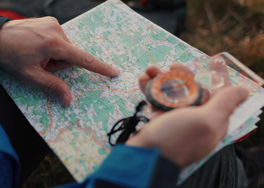
Government-issued maps are a public trust, a promise to help people explore America’s public lands safely. Yet they no longer reflect the reality on the ground.
Etched into sandstone, between chaparral and along coastal ridgelines, the trails of California’s Los Padres National Forest are fragile things even without the complication of a rapidly changing climate. Many of them were built for purposes that no longer exist—cattle drives, mining prospecting, early U.S. Forest Service fire patrols—while others were packed by the footprints of the Chumash people well before the colonization of North America. Sections of trail cling to steep slopes that seem to barely resist gravity, shedding soil and stone with each winter storm. Look carefully and you can still see the old bench cuts and hand-built retaining walls, half-buried or swallowed by manzanita.
That fragility has accelerated throughout the nation’s trails system as droughts deepen, floods intensify, federal budgets thin, and wildfires multiply.
Across the country, trails listed as open on official maps slip off mountainsides, Re:Public reports. Drainages carved into sandstone blow out over the course of a single atmospheric river. What remains is a system shaped more by erosion and abandonment than by the agencies meant to sustain it.
A single missing trail line in a dataset can alter a federal budget request by hundreds of thousands of dollars, since appropriations requests are tied directly to the total mileage in an agency’s database. Likewise, an “open” trail symbol on the National Map—the collective database maintained by the U.S. Geological Survey’s National Geospatial Program—can mask years of storm damage. Corridors painstakingly cleared can disappear within a season without constant maintenance.
The Forest Service manages more than 370,000 miles of roads, enough to circle the Earth nearly fifteen times, and roughly 160,000 miles of trails—85% of the trails on federal lands. Last November, a stark internal Forest Service report came to light, underscoring the very sorry state of those trails. In a Trail Program Status Report obtained by The Washington Post, Forest Service districts reported a loss of up to 100% of trails staff, hundreds of years of trail expertise lost, and “widespread burnout and declining morale.” Trail miles maintained were 22% lower than average, and the number of miles meeting maintenance standards was down 19%. It was the lowest level in 15 years.
Decades of underfunding have contributed to this decay. According to a 2022 Congressional report, the agency estimates a $460 million backlog in trail maintenance alone, part of a larger, $10.8 billion infrastructure deficit. Natural disasters like fire, flood, and beetle kill erase infrastructure faster than staff (if they are even present) can rebuild. Across the West, volunteers and small nonprofits have become the de facto caretakers of national systems.
Here in the Los Padres, the Forest Service’s backlog in trail upkeep is evident. Storms, wildfires, and heavy use have eroded once-iconic routes into deep ruts, overgrown seas of chaparral, and washouts. Of the hundreds of miles of trail in this national forest, volunteer crews now do much of the work, leaving countless miles unmaintained and their histories erased.
That’s not uncommon. In fiscal year 2023, 71,660 volunteers contributed 2.6 million hours of service to the Forest Service, more than double the hours logged by agency employees. Yet even that tidal wave of donated labor can only slow, not reverse, the decline of infrastructure compounded over decades of mismanagement.
What’s behind all this deferred maintenance? According to Forest Service staffing reports from 2019, the agency’s workforce has contracted substantially over the last 30 years, losing roughly 20% of its staff. Under the Trump administration, full-time staffing has decreased by an additional 10%.
Recreational trail staff, once robust in the 1980s, has dwindled with these reductions in force, with many districts reporting zero, or just one, permanent recreation staff and fewer than three seasonal staff to oversee hundreds of miles of trail. A July 2025 internal Forest Service report, shared with me by a confidential source, concluded that each of the agency’s nine regions was missing up to 80% of their trail and recreation workers.
Last December’s follow-up Forest Service report quoted a chorus of disaffected anonymous rangers. “My trail program is suffering the worst morale setbacks of all my district programs,” said one acting district ranger. “We lost 200 years of trail experience this year,” said a forest recreation manager. One district trail manager was considering packing in a multi-decade career altogether. “It feels like 24 years of trails and wilderness work,” they said, “rolling back to the bottom of the hill.”
Maps are meant to show people what’s real. They mark the contours of belonging: where one can go, where shared inheritance still lies. Especially when produced by government agencies, they underpin the laws that guarantee access, guide wildfire response, and shape billions in recreation spending. Yet for decades, even federal land managers have struggled to keep track of where legal access actually exists: on easements handwritten in filing cabinets, in decades-old agreements never digitized, and on trails shown on one map but absent from another.
That’s why, in 2022, Congress passed the MAPLand Act: Modernizing Access to Our Public Land. The bipartisan bill directed the Forest Service, Bureau of Land Management, National Park Service, and Fish and Wildlife Service to locate, digitize, and publicly release every recorded access easement, trail, road, and boundary by 2027. On paper, the mandate is straightforward: consolidate a century of scattered records into a single, authoritative digital basemap.
But the reality is far messier. The National Map lists roughly 300,000 miles of official trails across public lands. OpenStreetMap (OSM)—the public, volunteer-driven dataset that underpins most private navigation apps, including Gaia GPS, Strava, Apple Maps, and AllTrails—adds hundreds of thousands more, capturing both sanctioned routes and informal paths from phone GPS data. Errors and omissions in federal datasets flow directly into these apps, but the reverse is also true: the proliferation of unsanctioned user-generated trails feeds back into agency workloads, complicating maintenance priorities and stretching already thin resources.
The latest MAPLand implementation update, presented at a webinar hosted by the nonprofit group American Trails in September, showed that while agencies have made progress compiling existing digital layers, vast swaths of paper maps, access agreements, and legacy easements remain undigitized. Not since 2012 has the Forest Service met its goal to get out in the field and verify 1% of its trails every year.
The effort hasn’t stalled entirely. Even as the administration proposed massive cuts to the Forest Service’s budget, Interior Secretary Burgum funneled limited funds toward access-related projects, including the digitization mandate, responding directly to lobbying from groups like Outdoor Recreation Roundtable. However, this political momentum has not solved the core problem: we need more boots on the ground.
The basemap that is emerging, while ambitious, is still incomplete and often inaccurate. The funding is sufficient only to compile the existing digital layers—not to send staff into the field to research paper records and trail segments lost to the system decades ago. The effort has thus drifted toward producing a polished product—a clean digital layer based on the data they already have—rather than the honest result of expensive, on-the-ground verification.
In the end, the public may end up with a map that looks authoritative while obscuring the very gaps the MAPLand Act set out to fix.
The issues arising from the Forest Service’s underfunding take on forms as diverse as the nation itself. In Oregon, for example, drought and beetle kill—which worsens as climate change forces later autumn freezes—have left entire slopes of standing dead trees.
When winter windstorms roll through, hundreds of thousands of those beetle-killed trunks come down like matchsticks. Crews return each spring to find trails buried beneath tangles of blowdown, making once-beloved routes impassable for months, sometimes years. The scale of disturbance is so vast that even full trail crews, much less volunteer groups, cannot keep pace. And those downed trees leave forests increasingly susceptible to wildfire.
There is perhaps no greater threat to the forests of the West than fire. A 2023 report by the nonprofit Outdoor Alliance, Wildfire and Outdoor Recreation in the West, found that more than 5,000 miles of trail are impacted by wildfire alone every year.
According to a 2023 analysis from the Regional Economic Development Institute (REDI), Colorado, for example, has averaged roughly 72 wildfires a year in the 2020s—a six-fold increase over the 1990s. Post-fire landscapes produce a second wave of destruction: deadfall that collapses across trails, unstable slopes that slough off during storms, and safety hazards that can keep entire networks closed for seasons at a time. Millions of dollars flow through the federal Burned Area Emergency Response program toward roads, culverts, and utility protections, but rarely toward trail reconstruction—leaving many routes functionally disappeared. Volunteers have worked to restore what trail they can, all under the tacit acknowledgement that another fire is all but guaranteed to make their work Sisyphean.
In other words, climate change is outpacing both the physical infrastructure on the ground—and the institutional infrastructure meant to care for it. A perfect example of this is going on right now in North Carolina. When Hurricane Helene struck the Pisgah and Nantahala national forests, torrential rain triggered landslides that buried trails under tons of mud, fractured bedrock, and toppled timber. Entire segments vanished in a single night. With roads, bridges, and community infrastructure devastated across western North Carolina, emergency funds and agency staff were diverted to protect travel corridors and utilities. Trails on public lands, already facing years of deferred maintenance, fell to the bottom of the priority list. Many remain closed—not only because the work is complex, but because no dedicated crews exist to reopen them, underscoring how quickly a maintenance backlog can become a loss of access.
Climate events, in this way, do more than reshape the landscape, they pull attention and resources away from it.
It is tempting to fault the government alone for the scale of losses like these, yet users of public lands must acknowledge their responsibility as well. Too often, outdoor recreation culture—and the industry that profits from it—has encouraged people to act as beneficiaries rather than stewards, enjoying access to public lands while contributing little to the labor or funding required to maintain them. Americans spend an estimated $1 trillion annually on outdoor recreation. Yet the specific federal accounts dedicated to funding its physical foundation—roads, conserved landscapes, and trails—are so limited that their totals are smaller than the annual operating budgets of some state park systems.
The ideal outcome would see federal agencies and the public working in concert to maintain trails as living infrastructure, guided by accurate, up-to-date mapping and coupled with full Congressional funding. Outdoor recreationists could play a more proactive role as well, perhaps through an excise tax or other dedicated funding stream that directly supports public lands. Hunters and anglers have been fueling federal conservation efforts through excise taxes and license fees for decades.
Maps are meant to do more than chart terrain. They function as a kind of social contract between the public and the agencies tasked with stewardship: a promise that what is shown can be found, used, and defended. Each trail denotes more than an opportunity to recreate, but a chance to stay connected with the landscape and the nation’s history within it. As the terrain changes faster than maps or management budgets can keep up, that contract frays. People cannot advocate for landscapes they cannot access, cannot experience, or no longer believe are intact.
People have inherited an empire of roads, trails, and easements carved through nearly every U.S.ecosystem. Some may deserve to fade back into the forest; others are lifelines for access and identity. The challenge is choosing which lines to maintain, which to erase, and which to fight to redraw. Every map revision is a moral one.
This story was produced by Re:Public and reviewed and distributed by Stacker.